Hike: Cascade and Porter Mountains
Distance: ~6.5 miles
Elevation: 4098 ft (Cascade) 4059 ft (Porter)
Total Ascent: ~2300 ft
Date: June 20, 2015
Discussions of a return trip to Cascade and Porter had been ongoing for some time between my brother Brian and I. He had been up Cascade a decade earlier, but had not caught Porter at the time. I had been up both 8 months prior, but the weather had prevented seeing any views. And so it worked out that we could gather on Father’s Day weekend to resolve these issues.
The plan was to make a quick trip to grab them on Saturday, and then do a shorter, less rushed hike with my dad and kids Sunday. We arrived a bit late at the trailhead, and were worried about finding a parking spot. However, we lucked out because someone had just pulled out right next to it. While we were getting ready to kick off, a small car attempted to park on the other side of the street and went in a bit far, until only 3 wheels were on the ground. I was about to run across and jump on his trunk, but thankfully he was able to back up and get the fourth back down.
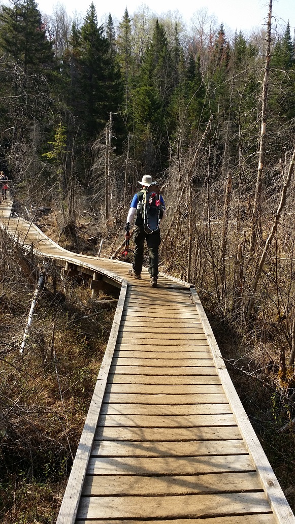
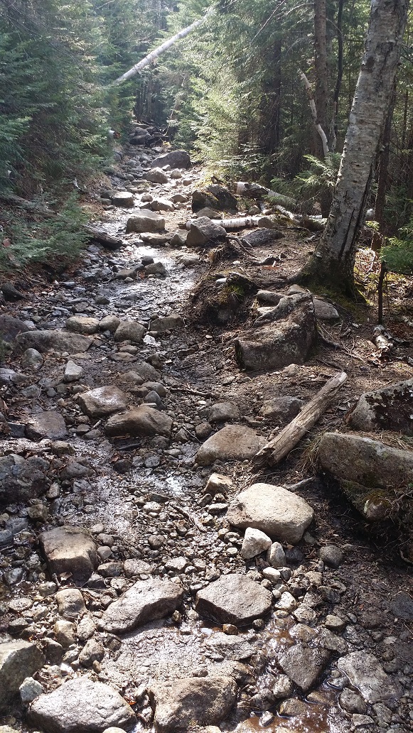
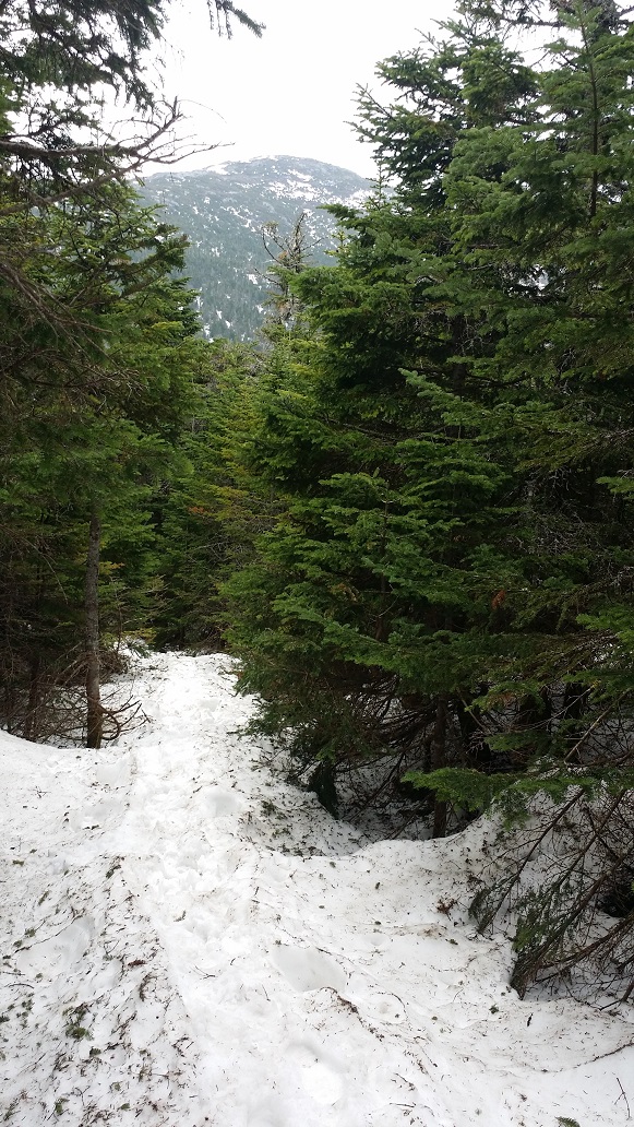
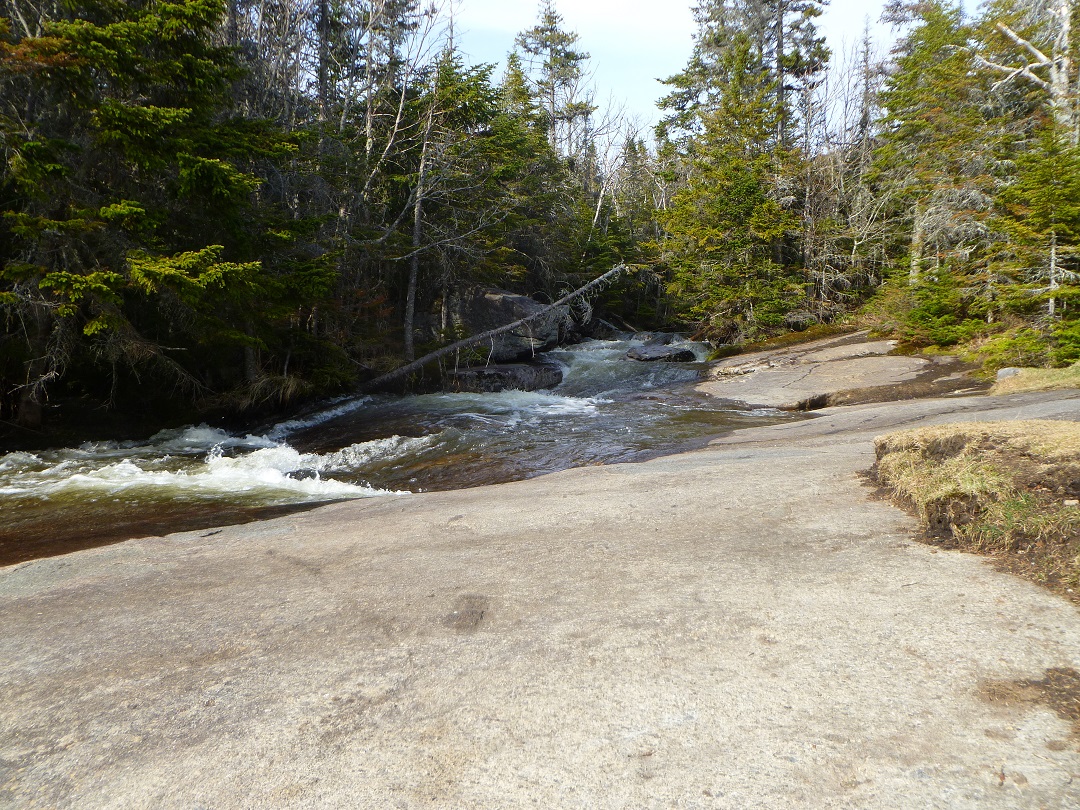
Stream Crossing on Cascade Trail
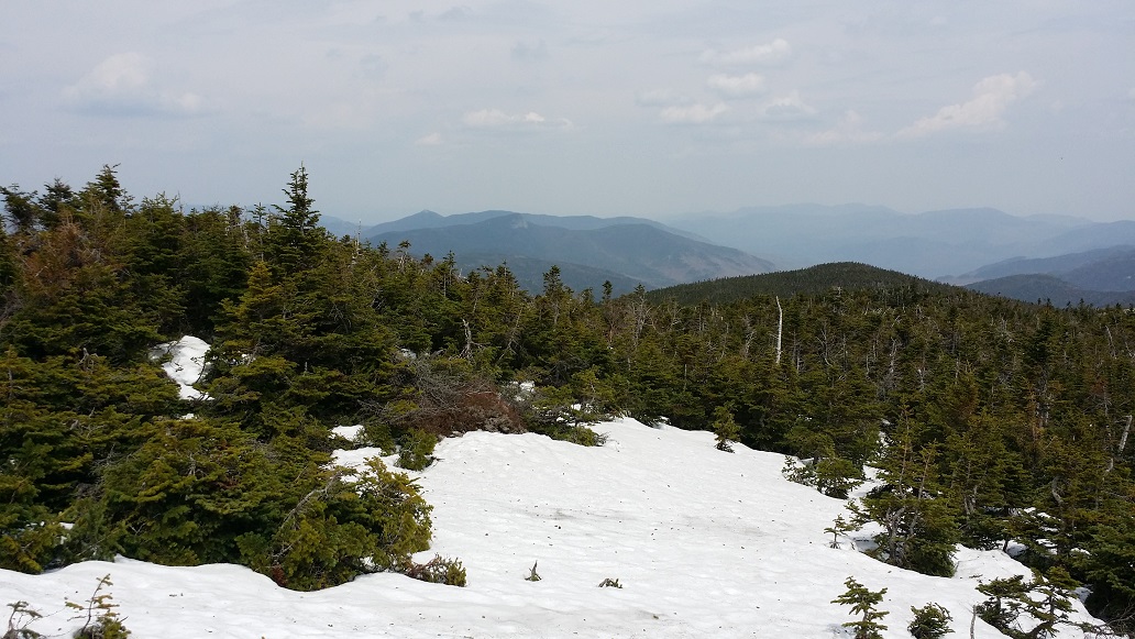
The hike up Cascade went fairly quickly and smoothly. We both felt like we were in pretty good shape after our Marcy summit a month prior, so we were excited to see how this went. Before we knew it we were on the last push above treeline.
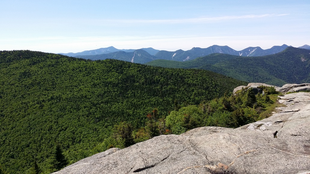
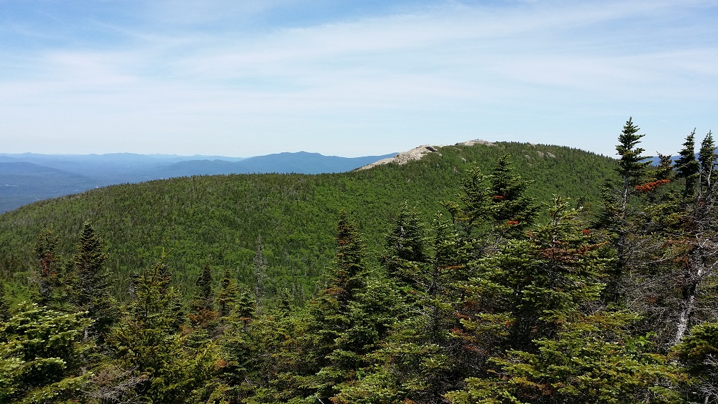
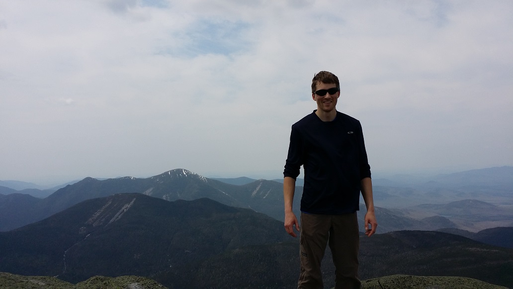
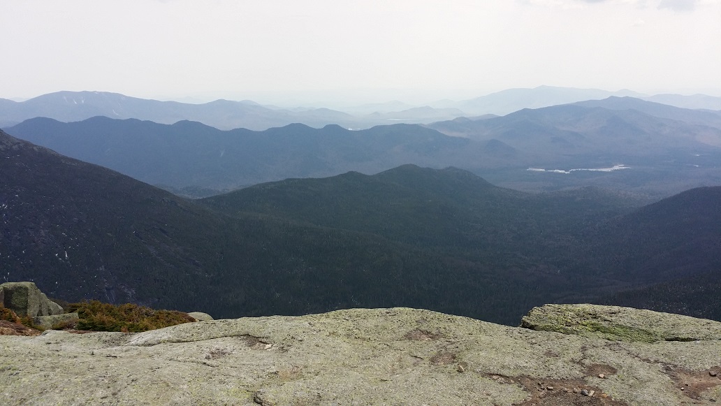
The ADK has a summit steward program which posts a person on many of the more popular High Peak summits during the summer months. They are there to educate hikers and keep them off the fragile plants that grow there. A very kind and knowledgeable young woman was posted on Cascade this day, and took our picture (the other, unofficial, duty of stewards). It’s one of my favorite pictures of us.
We were fortunate to summit during a lull, and spent quite a while chatting and enjoying the views.
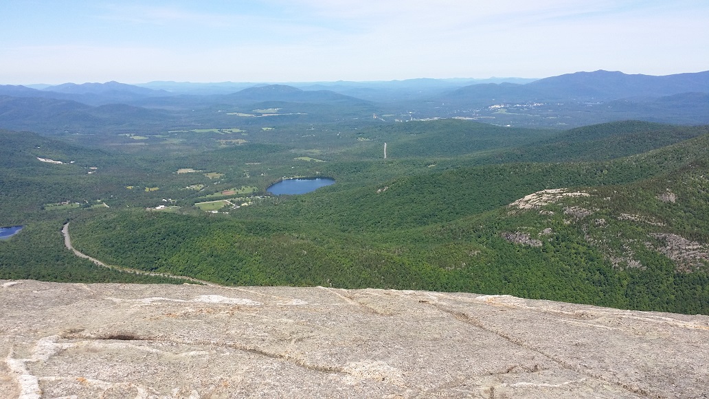
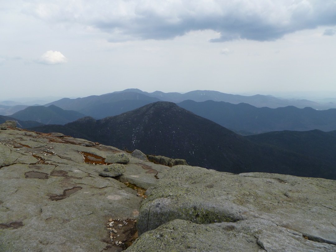
Dix, The Great Range, Big Slide over PorterMarcy, Colden, Algonquin, etc etcFacing East over Round LakeFacing North over Pitchoff and Whiteface
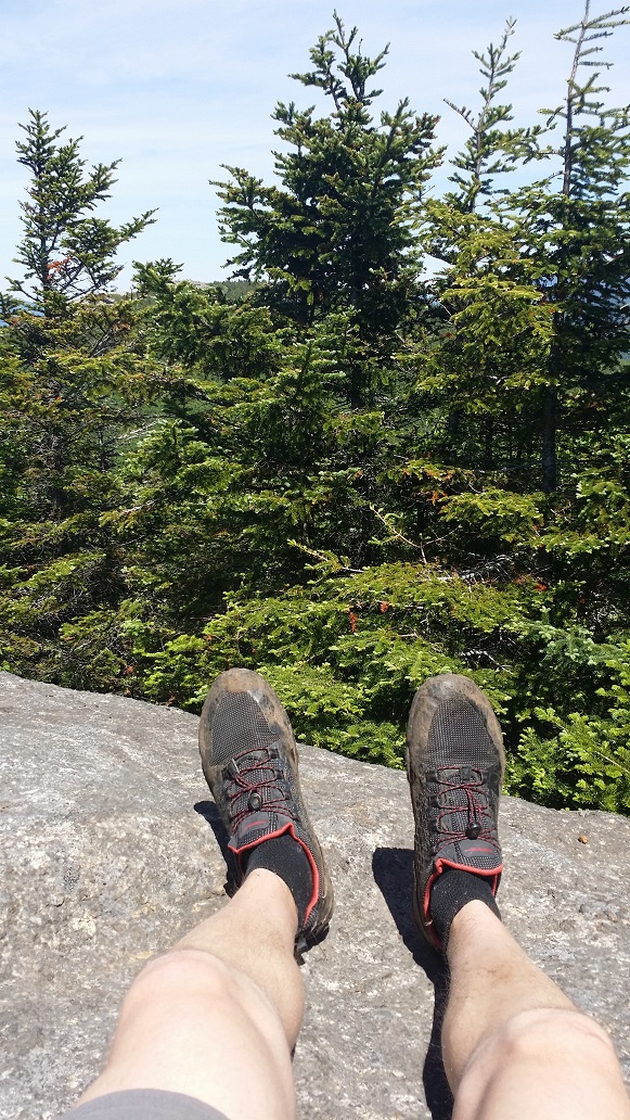
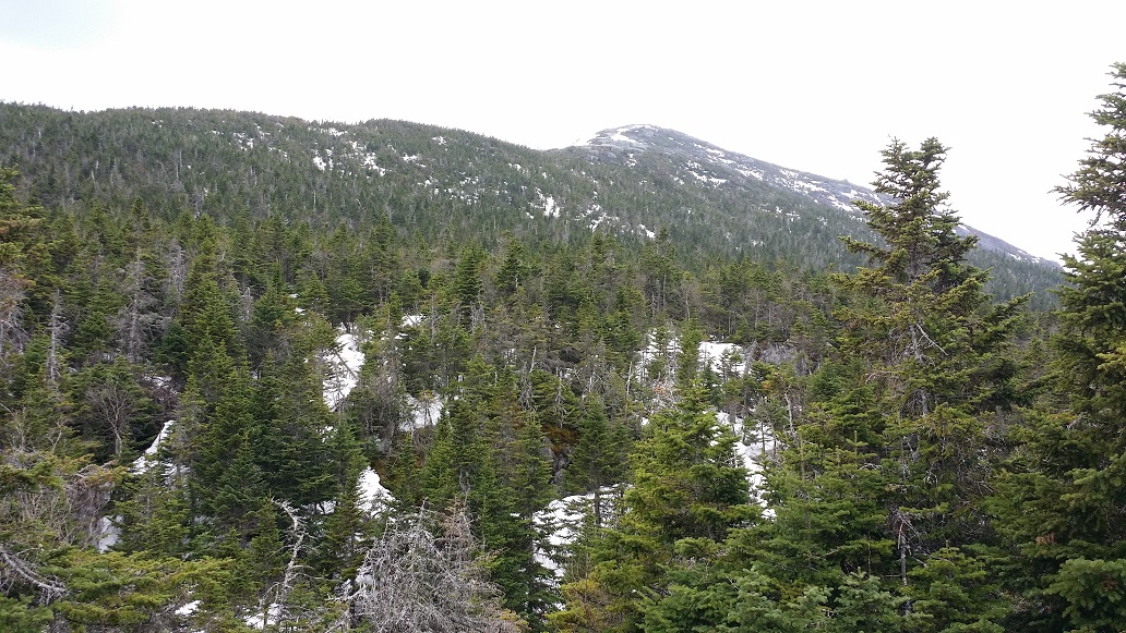
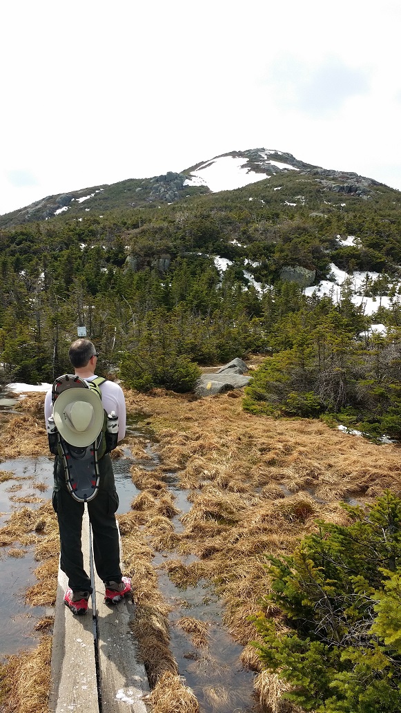
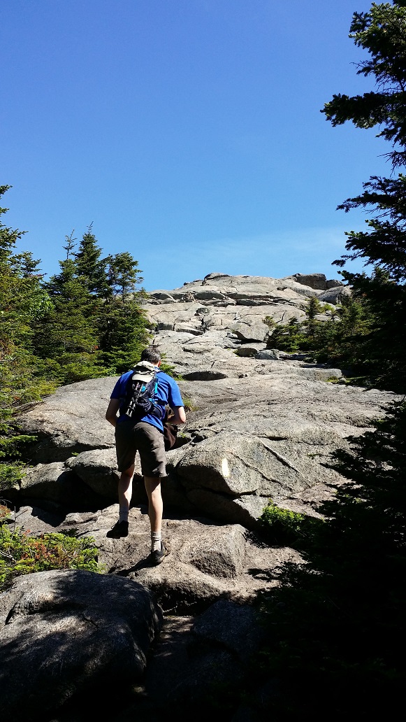
Feeling good, we hauled ass off Cascade back to the junction for Porter. There is a semi-technical descent for part of the 0.75 miles out to Porter. We passed a pair of women, one with a young child on her back, who was a 46er multiple times over. Climbing back up to Porter’s summit, the ascending fatigue returned and I slowed down. I still hadn’t achieved my climbing legs.
My Non-Beach LegsPorter
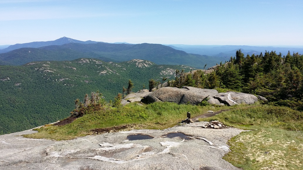
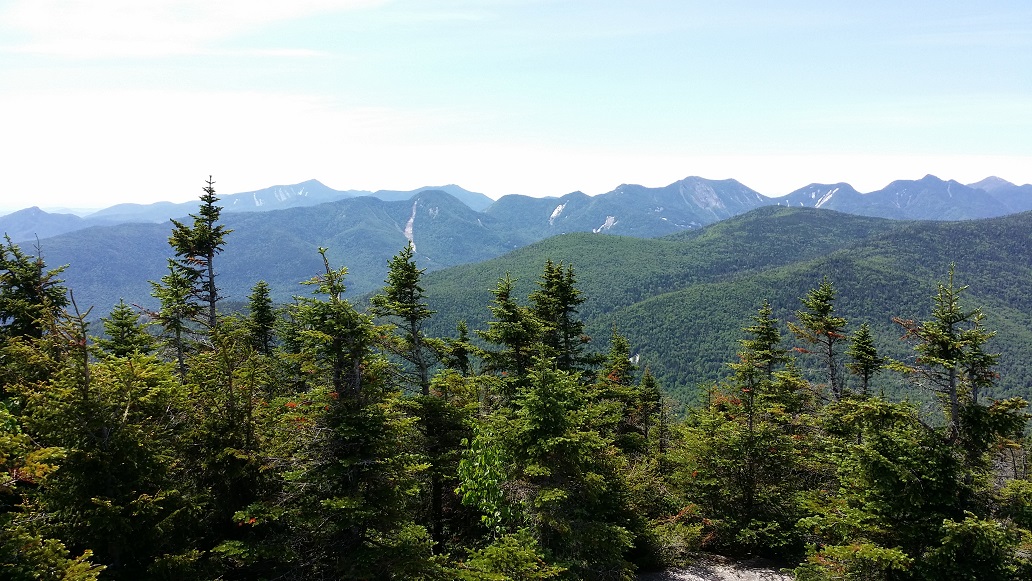
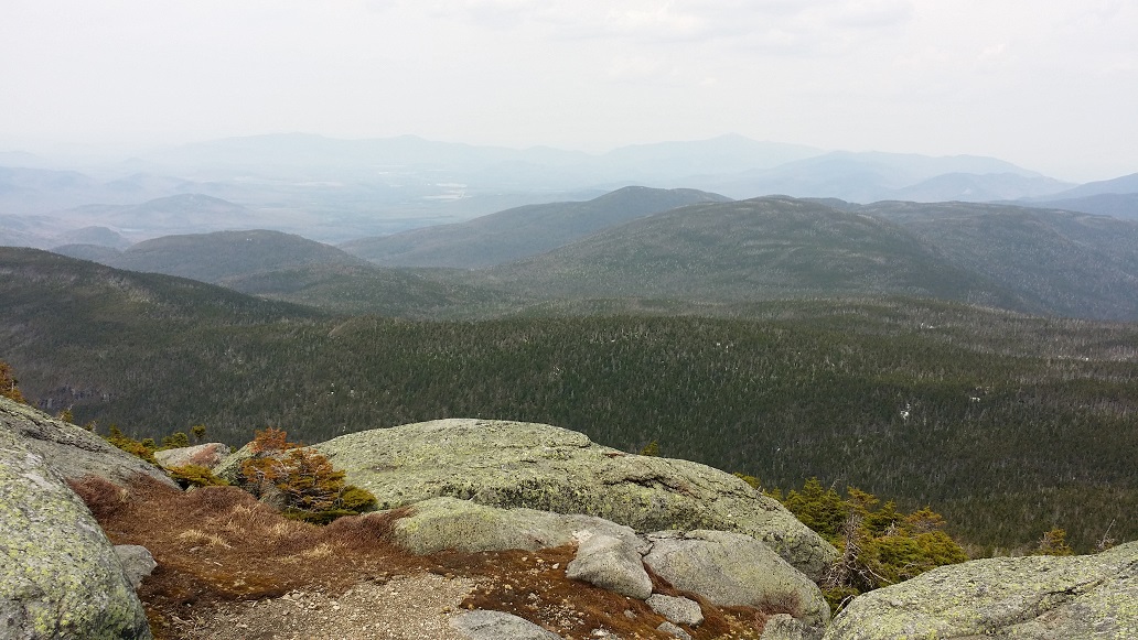
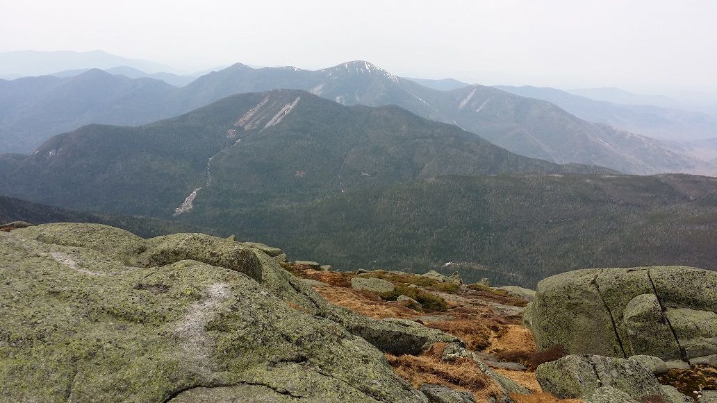
The summit of Porter is treed in, but it turns out there are still pretty good views over the tree tops.
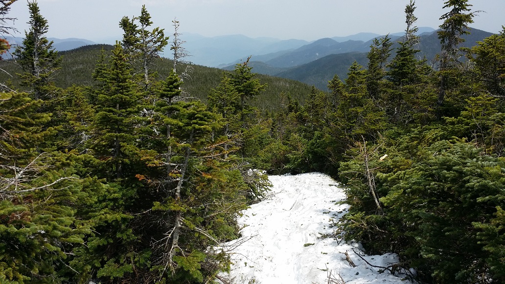
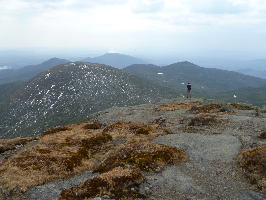
Cascade from PorterThe Great RangeBig Slide, Marcy, Colden, Algonquin
Hike: Mt Severance
Distance: 2.4 miles
Elevation: 1693 ft
Total Ascent: ~800 ft
Date: June 21, 2015
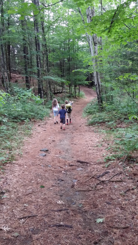
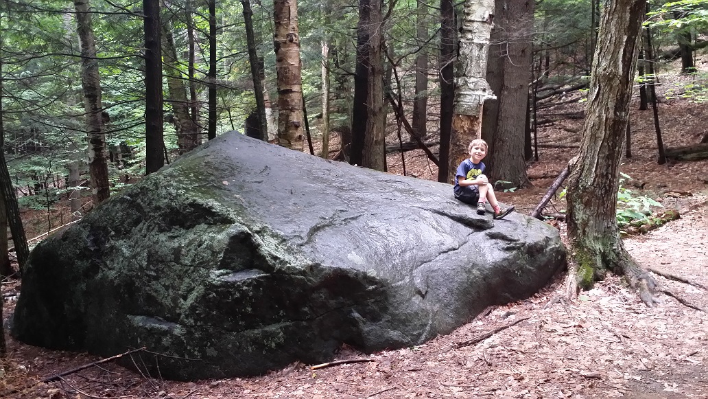
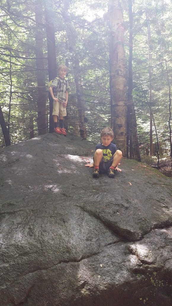
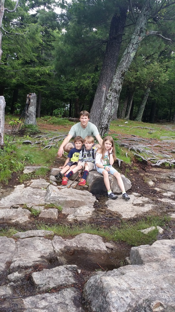
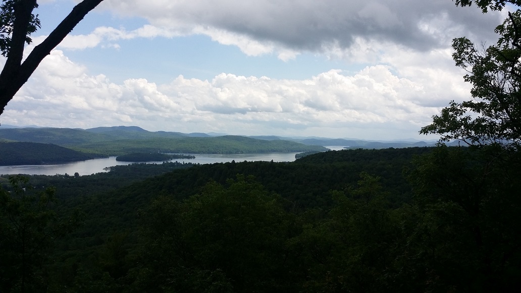
Sunday, Father’s Day, started with a nice motivating tantrum from my youngest. Clearly it was time to get into the woods. My children were not particularly interested, but I wanted them all to at least get a taste of the experience, and Mt Severance is a short climb with rewarding views, so it fit the bill.
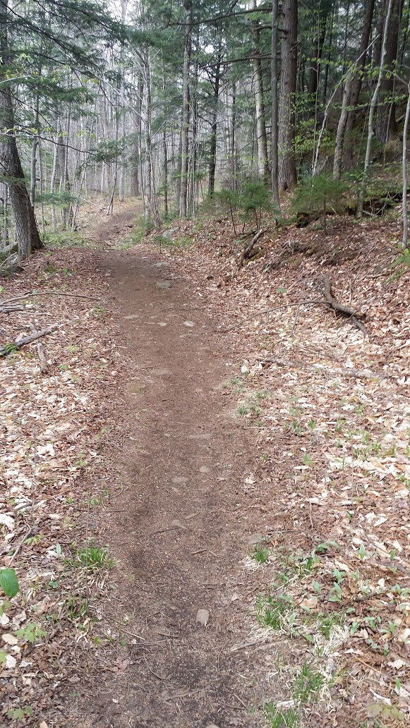
The trail starts by literally tunneling under Interstate 87, followed by crossing some bridges over a bog area. Then the trail gets pretty easy, with very gradual climbing.
Kids Are Off!Jenks Men
There are a few fun stops along the way, such as this giant rock.
King of the Mountain
Having become used to longer, taller hikes, it was a surprise when we came to the summit. Not to the kids, however. My daughter, especially, was not particularly enjoying the experience. She now says she’s happy to have a helicopter drop her on top and she’d be willing to walk down.
Hike: Mount Marcy
Distance: 15 miles
Elevation: 5344 ft
Total Ascent: ~3800 ft
Date: May 9, 2015
To say I had become a little obsessed with standing on top of Mount Marcy after our epic failure (er, solid attempt! … learning experience?) back in January would be the understatement of the year. Unfortunately life and poor Spring hiking conditions disrupted the flow, and the next opportunity wouldn’t come for several months.
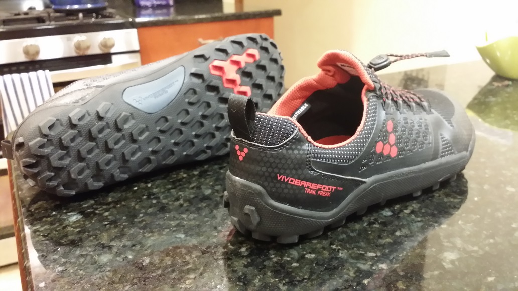
I was itching to try out my new shoes. I had spent months agonizing over what to slip my feet into once winter took its leave. I wanted minimalist shoes, but waterproof and with decent traction in the mud. A tall order indeed. Once I gave up on the idea of finding a boot I was happy with and began looking at sneakers, I happened across the Vivobarefoot Winterproof Trail Freaks.
After 200+ miles, I still absolutely love these shoes. They are designed for all season trail running and are 100% waterproof, as long as you don’t dunk deeper than your ankle. (I’ve developed the tip-toe step through deeper water.) I’ve heard the second iteration of this line isn’t as well liked, though, so your mileage may vary.
An opportunity for a little getaway finally presented itself for me and my brother in May. I was telling some friends about my plans a few days before the trip. “I’m heading to my parents’ house (sans kids!) from tomorrow through Monday. Hoping to get a couple hikes in. Maybe even another Marcy attempt (apparently there is still a couple feet of snow up there).”
My friends were unimpressed. “Oooh. You found a May vacation spot with snow. You’re really winning at the vacation thing.”
Indeed, it was hard to imagine feet of snow anywhere at this point. Spring was in full swing, trees and flowers blooming, the grass already pissing me off because I JUST MOWED, DAMMIT. But Brian and I heeded the reports and packed our microspikes and snowshoes, even with the high temperature in the High Peaks expected to be around 80F.
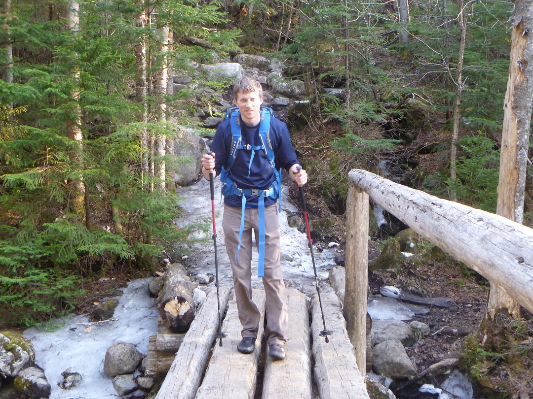
I had also invested in a nice pair of Black Diamond trekking poles that I was excited to get to know. The value of good poles became apparent on the last hike when mine had become useless, contributing to my hip failure. I expected to fully use their features on this day, with rubber and carbide tips, and removable snow baskets.
We set off from the Loj up the now all-too-familiar Van Hoevenberg Trail around 8:30am, feeling relaxed and excited. It was already warm, and we had hours more daylight to play with. There would be no freezing to death today.
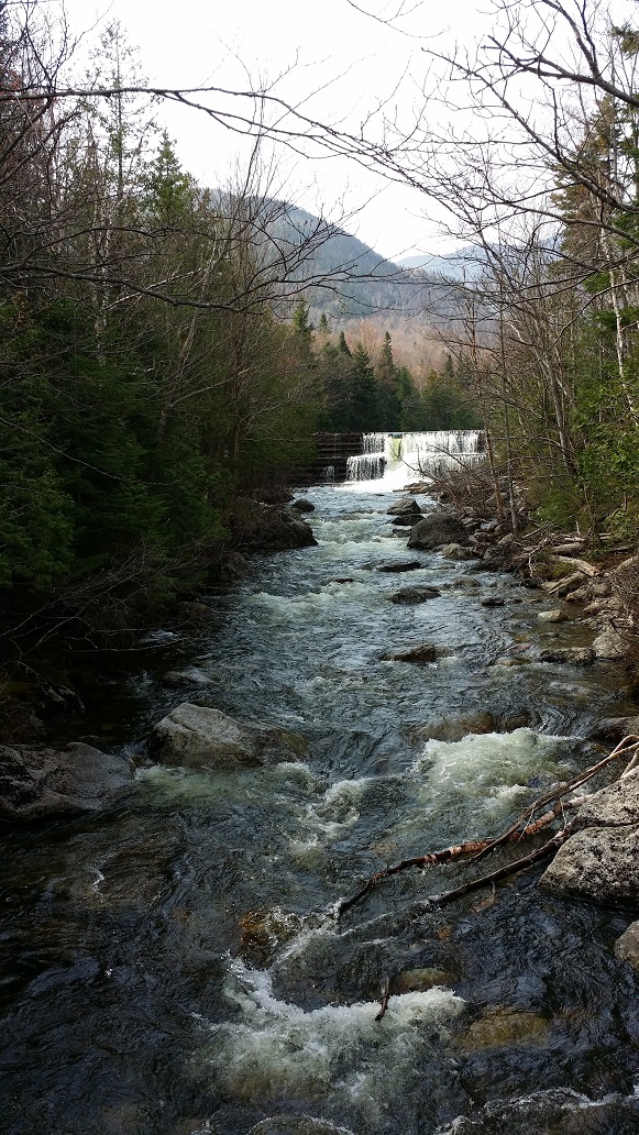
The trail to Marcy Dam was surprisingly dry. This was supposed to be mud season! It turns out all the water was in Marcy Brook, overflowing the dam hard, melting off the surrounding mountains in torrents.
I was also provided with my first view of Wright Peak not draped in white. The air was warm, moist, and gloriously fragrant with Spring.
We passed some college-aged guys, also intending to summit Marcy. They were wearing shorts, t-shirts, and sneakers, with minimal gear on their backs. I felt a bit apprehensive while talking to them, knowing the conditions ahead would be far different than down below, but on we all went.
This was the first time I had seen this section of the trail along Phelps Brook not covered in thick ice. It turns out it’s far rockier and harder to traverse. But it was fine. A little sweat wasn’t going to slow us down too much.
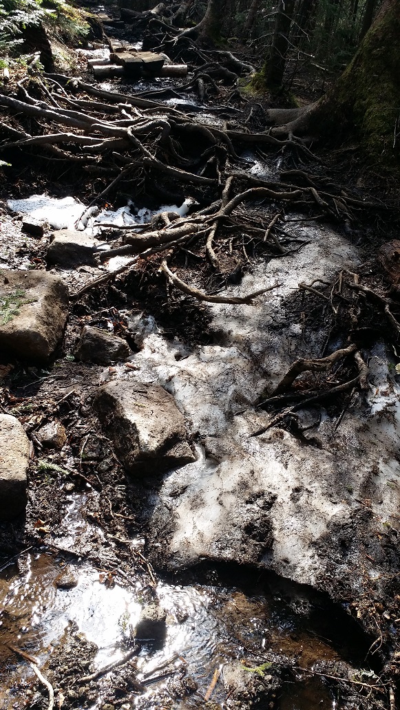
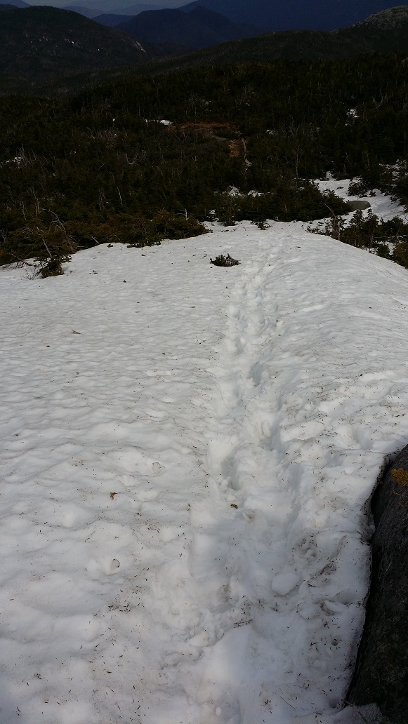
Once across Phelps Brook, the trail begins to steepen quickly. This was our first sign that winter did still exist up here, however minor. It was important to carefully watch our step, as the difference between ice, rock, root, and mud was not always obvious.
Around 3000 feet the patchy ice turned to consistent coverage. Most of it was only on the trail itself, the spine, from having been packed down by hikers and skiers over the previous months.
The thickness of the snow beneath us quickly grew as we climbed, even though the warm temperatures had it melting in buckets. We could literally hear the water rushing in rivers below our feet, finding its way down the mountain into Marcy Brook, over Marcy Dam, and eventually to Lake Champlain.
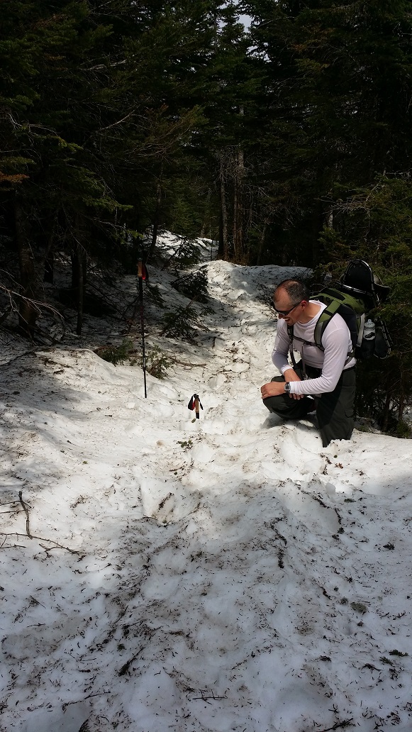
I had heard of postholing before, but never experienced it myself to this degree. If we were careful to step in the exact middle of the worn path, where others had packed it down well but hadn’t destabilized it by postholing themselves, then it was usually ok. A slight deviation would send us sinking to our hips. This happened, um, more than once. We passed a couple who were fleeing down in frustration, muttering about sinking every other step.
At one point, Brian put his pole in a hole I had just climbed out of to show its depth, and while doing so postholed himself. I had the pleasure of capturing the moment on camera.
One of the really cool things about this section of the hike was experiencing the battle between the cold and warm air. The ground and the sun were battling it out, and we were caught in the middle. A hot breeze would immediately be followed by an icy cold breeze, then hot breeze, etc.
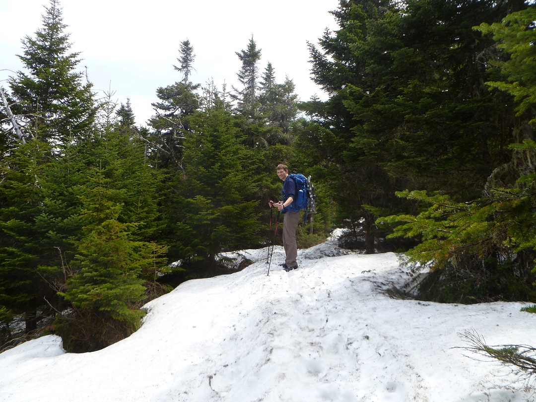
Finally we made it to our turn-around point in January, feeling much stronger and more capable than back then, despite the battle with the unstable trail.
We elected to continue on without our snowshoes. We received a few compliments at being the only ones on the mountain with the foresight to bring them, but that doesn’t mean we were smart enough to put them on our feet. One guy joked about wishing he had brought his raquettes, and another asked, “To play tennis?”, much to the delight of the rest of the group. It’s the little things.
Much of this section of trail was easier hiking. The snow pack was more stable, and we could trudge along without worrying about constantly postholing as much. It felt exciting to be further along than I had ever been before, seeing new trail that had been haunting my dreams for several months.
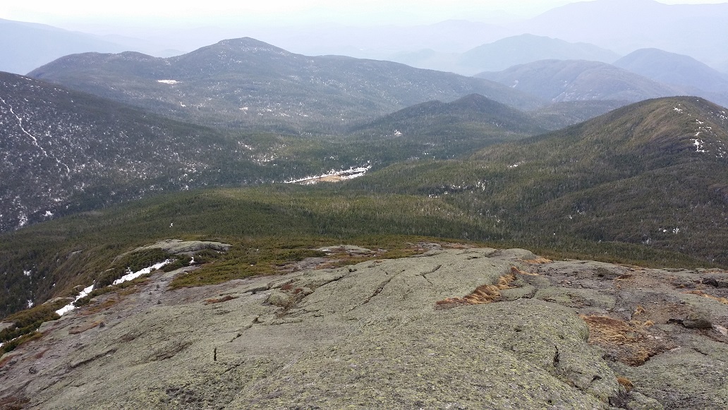
It’s often worth a look over your shoulder when climbing.
Looking Back on Little Marcy
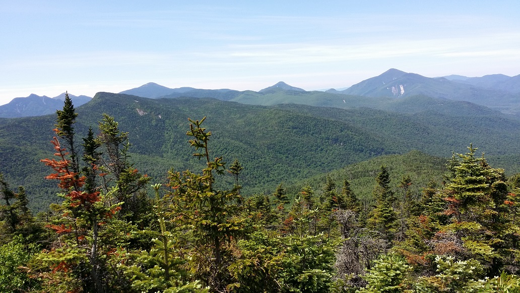
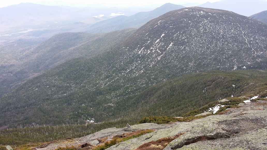
Exiting the trees, the views immediately became phenomenal. This is looking down the Great Range with Basin in the forefront.
View of Basin from TreelineLittle Marcy with Big Slide in the DistanceTabletop and Phelps
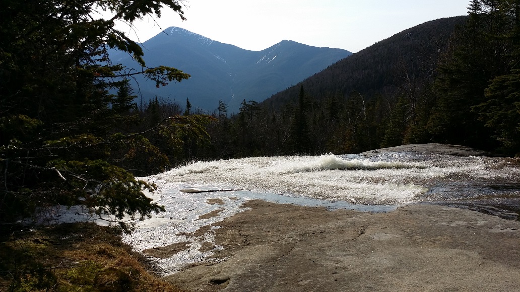
Nearing the top, the snow was largely gone, but what was left was ice. There were a few tricky spots where the ice was unavoidable. At one point we refilled our bottles from water pouring off a little baby glacier, figuring there was little chance it would be contaminated at that location, since there was no upstream.
Finally, it was done. The summit of Mt Marcy. It was breathtaking, and we even had it to ourselves for a short while. We spent nearly an hour and a half relaxing, eating, and exploring.
Although it was not a crystal clear day, the views were still impressive and well worth the trip.
Colvin RangeColden and the MacsSkylightLake Tear of the Clouds, the highest body of water in New York and the start of the mighty Hudson River.Haystack – Image credit: Brian Jenks
This is one of my favorite shots from the day, taken by my brother. It brings me back to that moment, standing atop Marcy and taking it all in. I was dreaming of exploring down there, beyond Marcy, experiencing Skylight, Lake Tear of the Clouds, Gray, Redfield, and Cliff from the west. It would be more than a year before that dream would become realized.
After the break at Indian Falls, my arthritis decided to kick into high gear and my knee gave out. The descent through this section is the most technical of the entire trek, and I was crawling. It was frustrating as hell, for both me and my brother.
A few years prior, I had an arthritis episode that lasted for months, and was so severe I could barely walk, couldn’t do normal chores or pick up my kids, at times couldn’t get into or out of bed without assistance. I was diagnosed with reactive arthritis, and had been learning about it and my body since, and how to best manage it. Clearly there was more to learn.
Just before crossing Phelps Brook, my brother dug some ibuprofen out of his pack and gave it to me. I had taken so much NSAIDs during my severe arthritis episode that I had developed an emotional block against taking them, not wanting to return to that saga. But, duh, they can still help at times. And within 15 minutes I was back to cruising speed, my brother huffing behind me muttering under his breath, because a few minutes ago he was waiting for me.
Hike: OK Slip Falls
Distance: 7 miles
Date: May 10, 2015
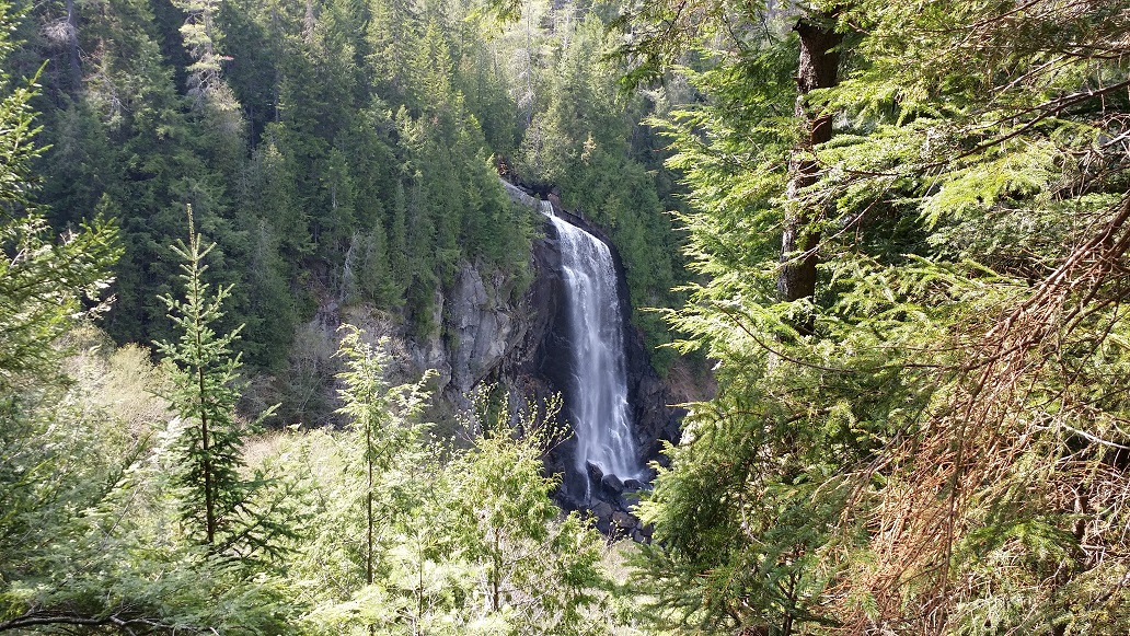
The next day, my brother and I wanted to do something with our dad, but, for obvious reasons, nothing too crazy. We decided on OK Slip Falls. This had recently been opened up to the public, and was a fairly level, 7 mile round-trip hike with one of the tallest waterfalls in New York at the terminus.
The conditions were quite different from the day before. Some mud, but mostly dry, easy trail. Our legs complained at first, but once we got going it felt good to stretch them out.
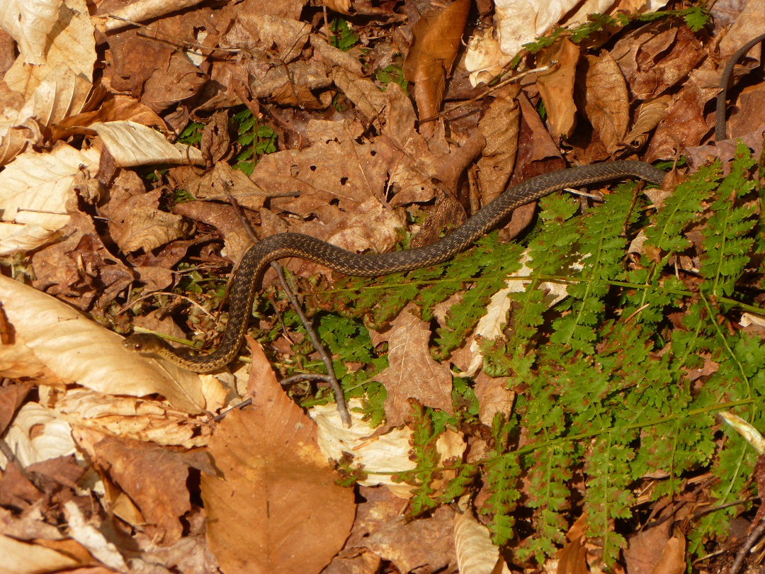
There were many snakes on the trail. I lost count of the times I’d hear some rustling and stop to scope what was making it, only to find a little snake slithering out of the way.
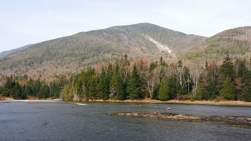
The falls were absolutely stunning. There is a trail to hike around the rim, but weather was moving in, and we were all tired. The end of the trail, where this view is from, is quite steep. I wouldn’t recommend letting small children run wild here.
On the way out, the skies opened up. Brian and I neglected to put our ponchos on. It absolutely poured and we got soaked. Fortunately the temperature was mild, and it added to the adventure and the memory.
After a beautiful and successful few days of hiking, it’s time to drink wine and get out the maps to plan the next adventure!

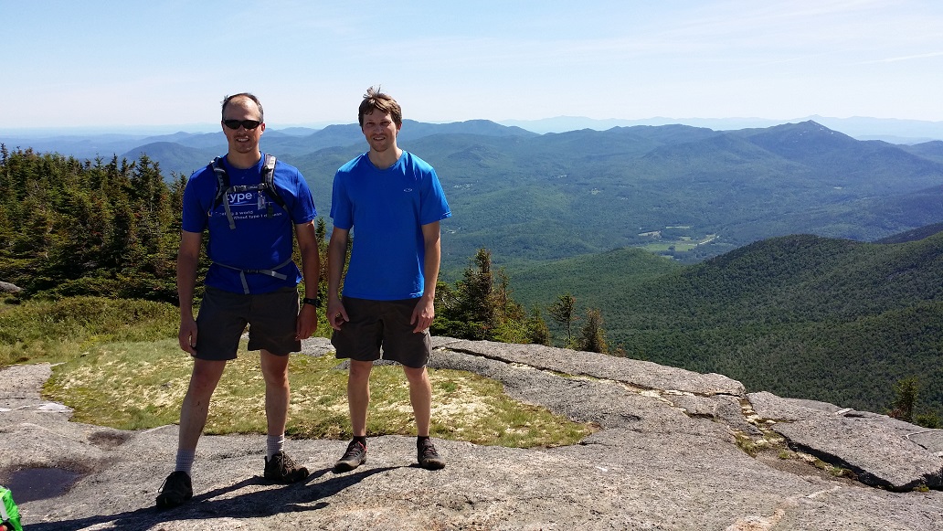

 The ADK has a summit steward program which posts a person on many of the more popular High Peak summits during the summer months. They are there to educate hikers and keep them off the fragile plants that grow there. A very kind and knowledgeable young woman was posted on Cascade this day, and took our picture (the other, unofficial, duty of stewards). It’s one of my favorite pictures of us.
 We were fortunate to summit during a lull, and spent quite a while chatting and enjoying the views.