The Great Range Part I – Game Changer

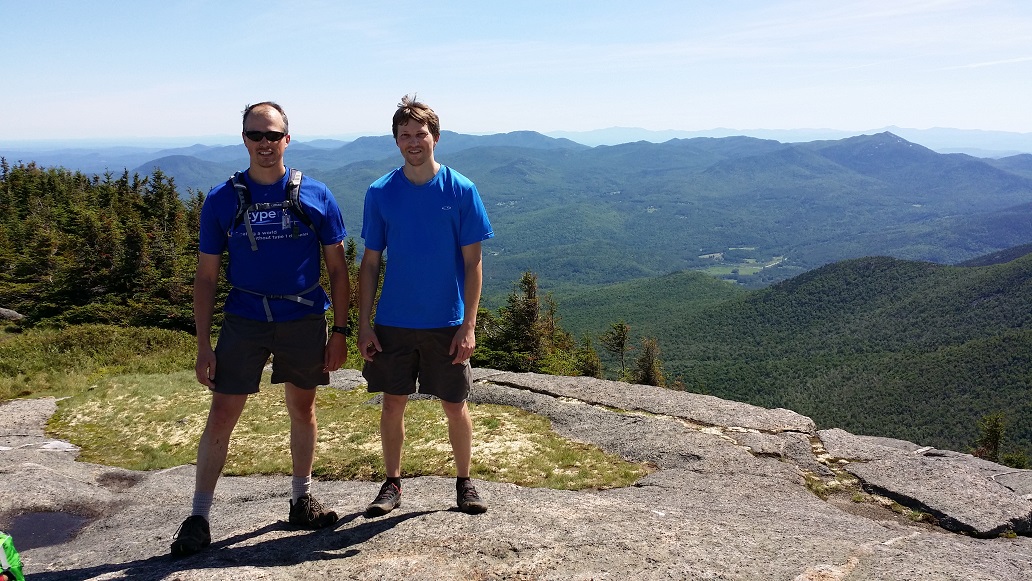
I suspect most hikers have one pivotal hike that changed everything, that opened their eyes to what is possible, to a deeper sense of what the mountains have to offer, to what the human body is truly designed for and capable of. This is the story of mine, when I learned to flow with the current of the mountains, and the struggle of the hike turned to weightless joy.

Hike: Lower Great Range
Distance: 17 miles
Total Ascent: ~5000 ft
Date: July 26, 2015

Electronic dance music blasted from Zebra Supervan’s sound system, the bone shaking beat keeping me awake and drowning out my nerves. “You’re fine. Everything’s fine,” I told myself again. Perhaps once more and I’d believe it. I get nervous entering into new situations, especially alone. Night was settling in and I was heading north on I-87, to a place I’d never been, to do something I’d never done, to push my body farther than it had ever been pushed before.

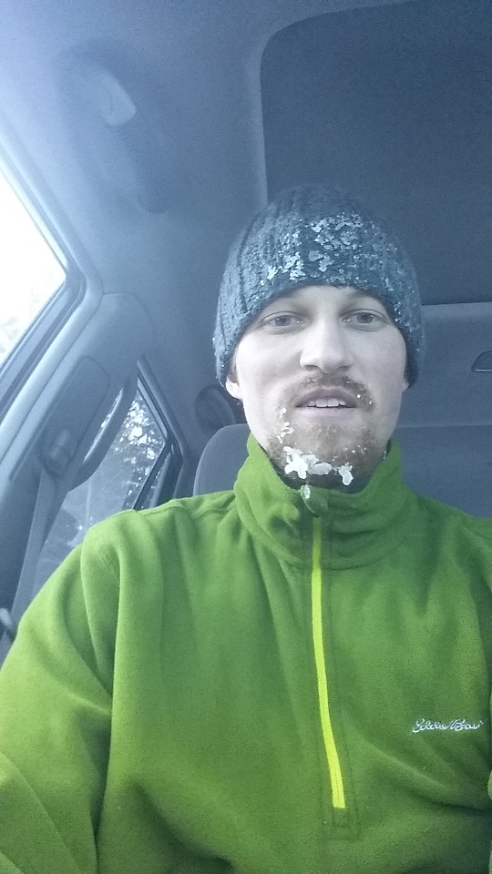
A few hours earlier my ex-wife had sent me off with a hug when she picked up the kids. I asked her if I smelled like a hamburger. I had just grilled them for dinner, and didn’t want a bear mistaking me for one. She was the only person I had confessed my plans to, not wanting to worry my family. At least someone would know to sound the alarm if I failed to return.

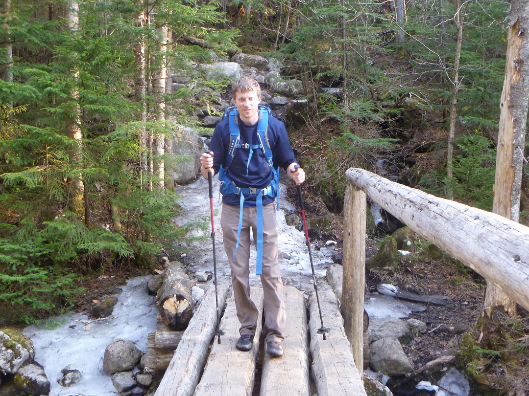
This was to be my first solo hike, and not a small endeavor. For months I had been wanting to push the limits of my body and see what I was really capable of, as well as try out a solo experience. My chosen target was the Great Range, a 12 mile 7 peak range in the heart of the High Peaks, containing some of the most challenging trails in the Adirondacks. I had no illusions of doing the entire range in a day, as some ultra-hikers do. I just figured I’d get up there and see how far I got. If things went well, I might even double the four High Peaks currently under my belt. I felt I had the stamina for it, but lack of experience and my struggle with arthritis left a lot to chance. I could only trust in myself to handle the former, and hoped ibuprofen could successfully suppress the latter, as it had helped on Marcy two months prior.

My destination this night was the trailhead parking lot known as The Garden. I had not been there before, and had no idea what to expect. Would it be full already? Would I be the only one sleeping there? Was sleeping there even allowed? Would it be deserted and a target for the Boogeyman to  harass idiot hikers in the middle of the night?

I found the turn off Route 73 at the Ausable Inn in Keene Valley, and slowly crept up the narrow winding road out of town, into the black wilderness. A giant boulder right up against the road, a one lane bridge, small cabins with a single light on, all engraved themselves into my memory. A few hikers were walking down the road with headlamps, finishing their long day, apparently unable to park in the lot that morning. This did not bode well. But onward I crept into the forest, until the road became a narrow single dirt lane, and finally, around 10:30, I came to a STOP sign.

Spread before me, illuminated by my headlights, surrounded by giant trees, was a large dirt parking lot scattered with cars. A few hikers milled about with headlamps, packing up, their adventures complete. I felt like an interloper, shining my artificial light and disturbing the night creatures. There was no turning back now, no pretending I was never there.

A few spaces were open. I pulled into one, killed my engine, and cut my lights. All went black and quiet, save for a few muffled voices drifting in. I allowed the stillness to settle over me for a few minutes to give my eyes and mind time to adjust. Then I donned my own headlamp and stepped out into the cool mountain air. Using the red beam to save my night vision, I made my way back to the parking attendant’s shed, long since deserted, to slip my fee into the slot and get my ticket.

Back in my car, I settled in for the night by popping open the hard cider and book I had brought. Planning ahead paid off. After reading by headlamp for a bit, cider drained, I scurried down into my sleeping bag and quickly overheated, my body turning the unventilated car into a humid sauna. Cracking the windows an inch made all the difference, and I drifted in and out of sleep listening to gentle rain.

Around 5am I figured I had pieced together at least a few hours of sleep, and, wanting to make the most of the day, decided to get moving. I nibbled on hard boiled eggs and washed them down with cold coffee I had brewed at home. Attempting to exit Zebra, my heart instantly shot into hyper-speed as my car alarm blared into the silent morning. Apparently one must unlock the car door with the key fob if that’s the way it was locked.

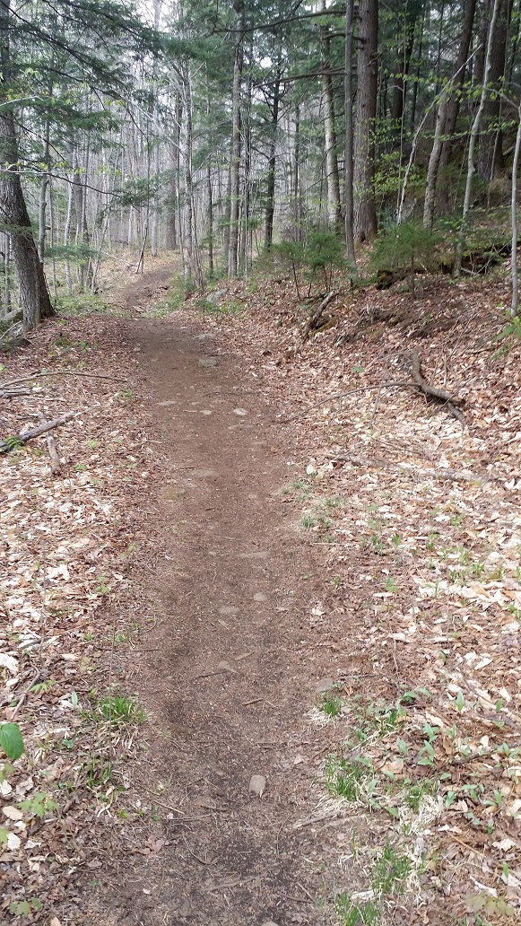
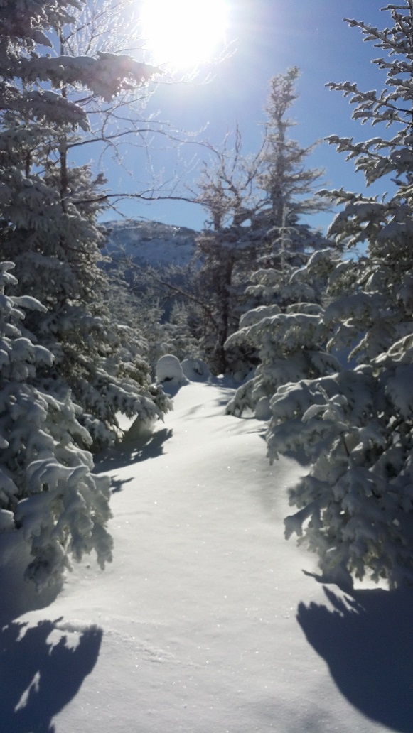
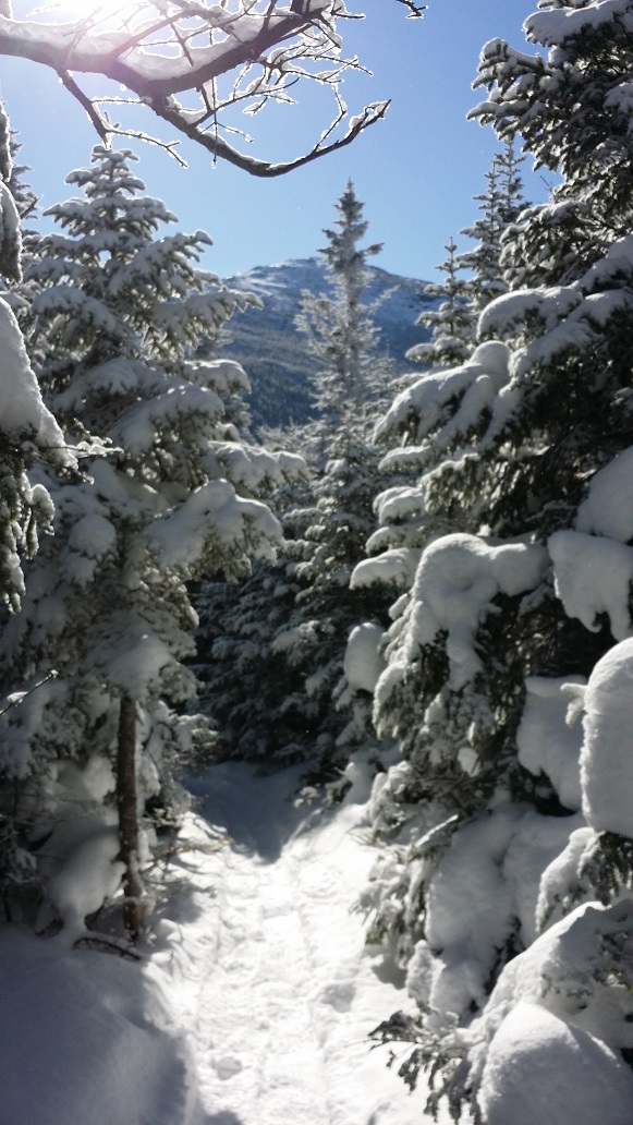
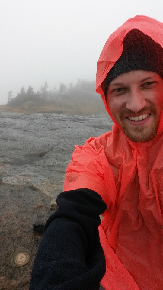
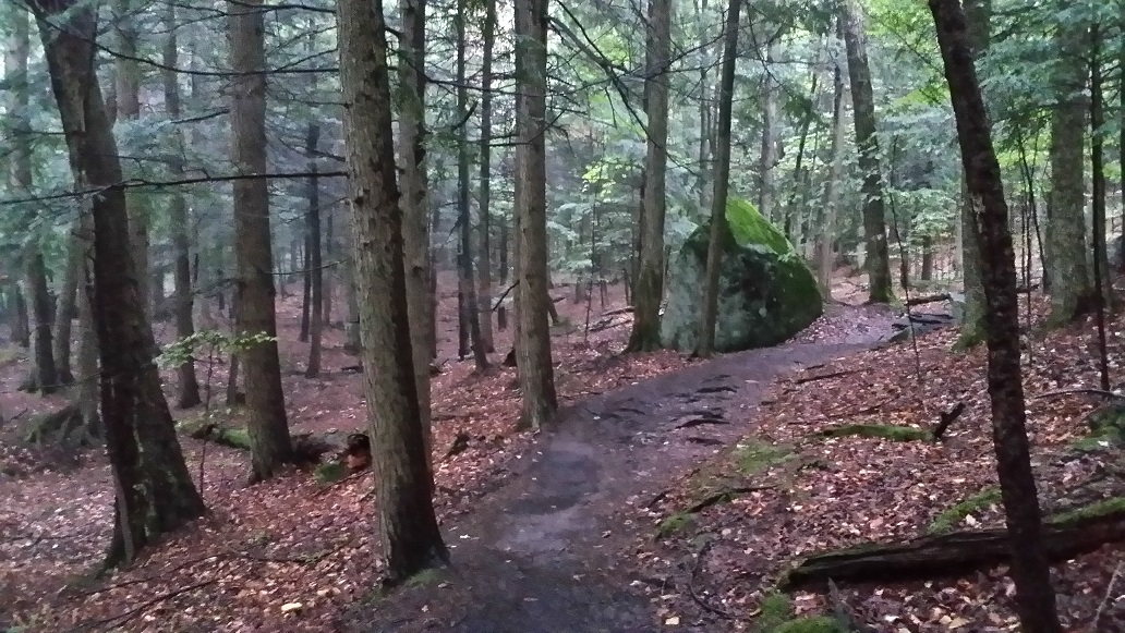
Just after 6 I hit the trail, only the 3rd to sign in at the register that morning. The air was cool, but thick and heavy with humidity from the night’s rain. It gave the forest a mystical surreal quality. My excitement was quickly growing and I ran the easier sections of trail to get my furnace fired up.

Magical forest in the morning

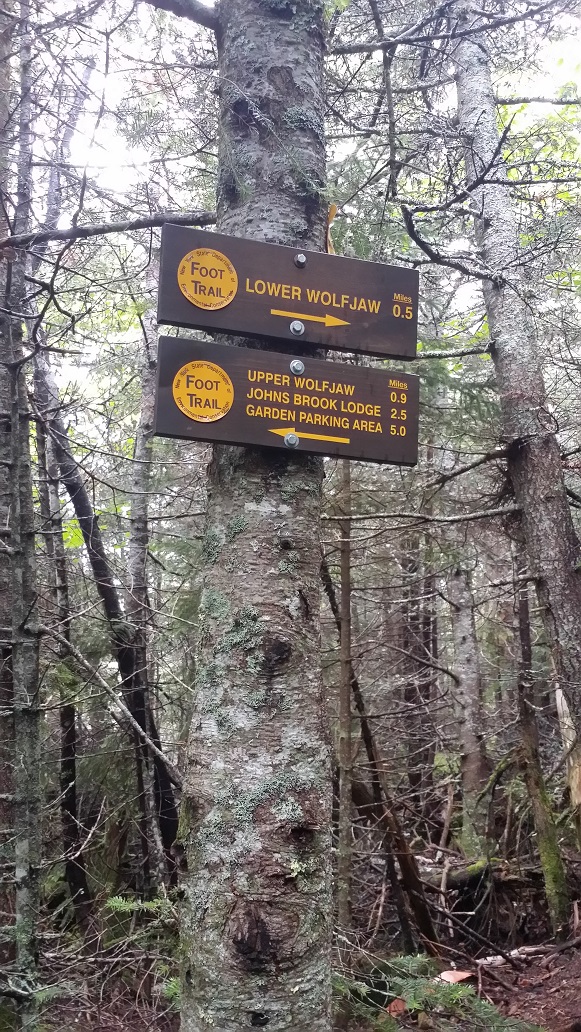
According to my map, the trail split after a short bit, leading to trails on both sides of Johns Brook. I planned to take a left, crossing to the east side of the river earlier to avoid having to backtrack to hit the start of the climb up into the Wolfjaws. However, when I arrived at the junction I was faced with my first dilemma. There was a large Trail Abandoned sign, stating that a bridge was out and the trail no longer maintained following the hurricane years earlier. I wasn’t excited to diverge from the itinerary I had left behind in case something went wrong, but I wasn’t excited about difficulties I might find with an abandoned trail, either. I decided the former was the lesser of two evils, being a far more trafficked and well-maintained trail, and forged ahead on the west side of the river.

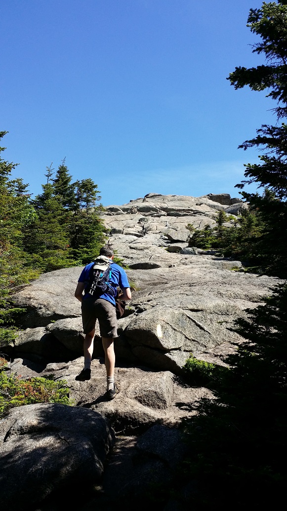
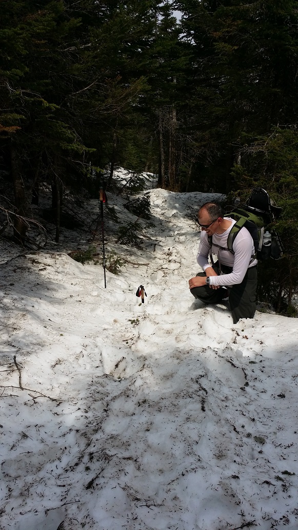
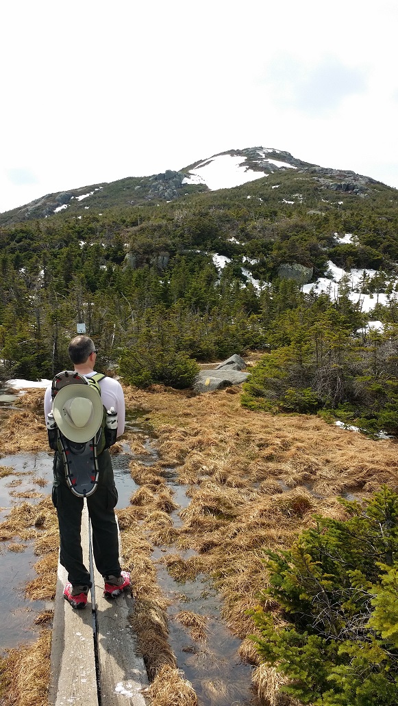
Being tall has great advantages in hiking. Longer strides cover ground quickly and efficiently. The frequent small cliffs and rocks found in the Adirondacks are easily scaled. Spiderwebs are easily caught with one’s face first thing in the morning. Actually, nix that last one. I was driven close to the brink of insanity by web after web after web. Finally wising up, every time I came near a crop of bushes, I’d wave my poles in front of me. Sorry, spiders. I hope you found a safer spot to rebuild.

One of the many tributaries draining off Big Slide down to Johns Brook

About 3 miles in, I finally encountered fellow human life forms. They had just packed up camp and were heading out. Right after that camping area, the trail heads a bit downhill to a junction and interior registry. Bearing right would take me to Johns Brook Lodge (JBL), which provides rustic but comfortable accommodations (and food!) on the interior for those not looking to camp. However, I was going left, as it was time to do what I had come here for, climb.

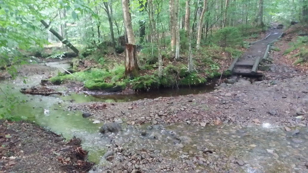
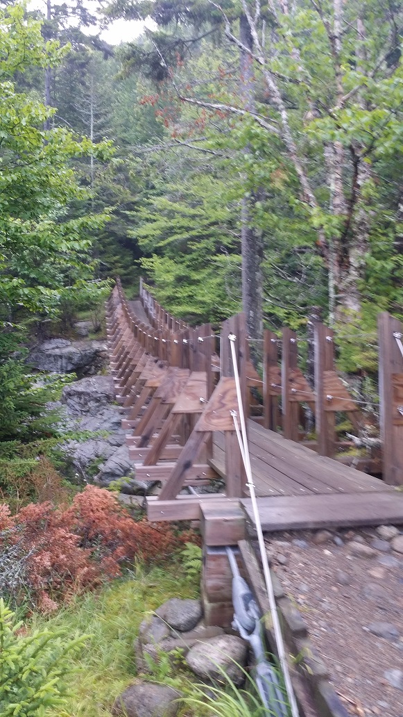
Passing the quiet DEC interior outpost log cabin in a stunning grassy field overlooking Johns Brook at the foot of the Great Range, I came to a suspension bridge. Bouncing across it, it was time to head left and backtrack a little down the abandoned trail in order to find the junction to the trail that heads up into the notch between the Wolfjaws. The trail really did have an abandoned feel to it, which I found disconcerting, and worried that I might have difficulty finding the junction. I thought I had it once, but decided it didn’t look quite right and continued on. I’m glad I did, because a short while later I found the actual junction to be obvious and well-marked.

DEC interior outpost at Johns Brook
Crossing Johns Brook
Johns Brook

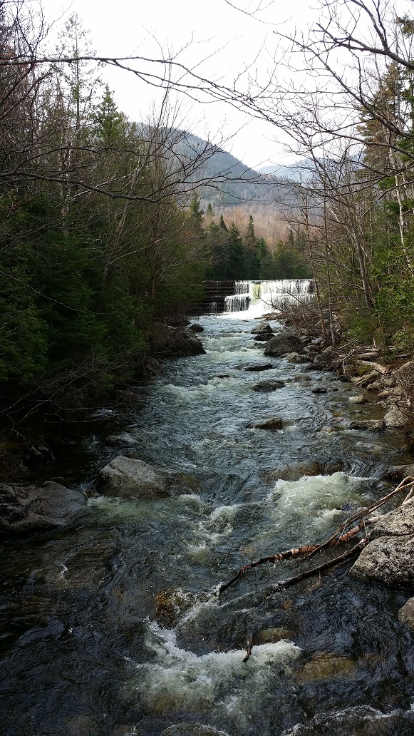
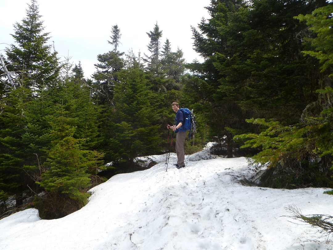
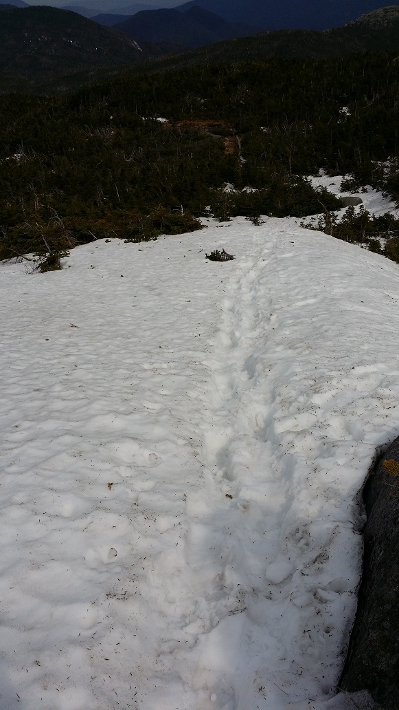
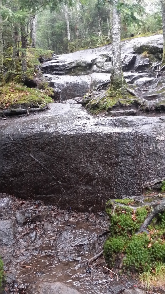
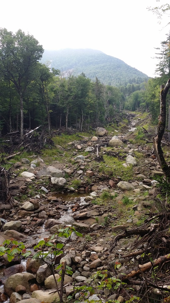
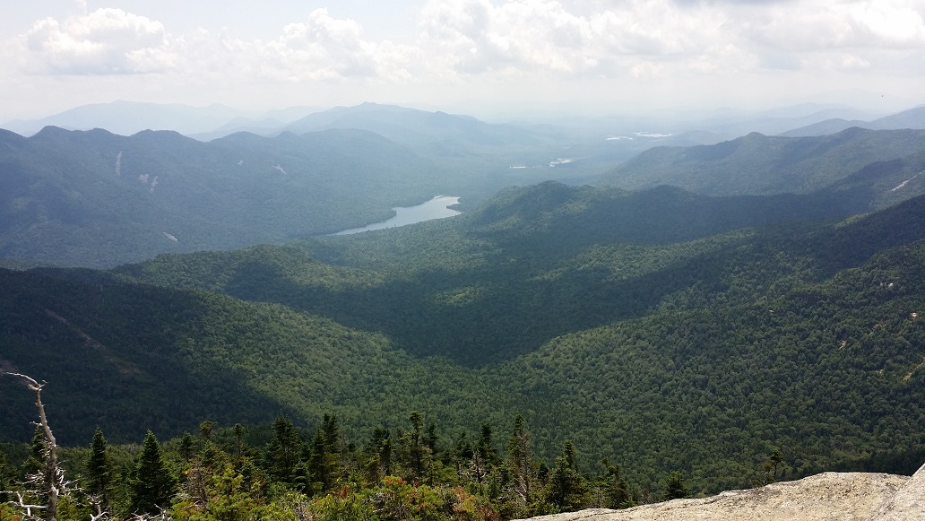
Up, up, up I climbed. It seemed to go on forever. I started wondering what the hell I was doing here and if it would ever end as my legs burned and I started to sweat profusely. Eventually I came to a lean-to, and crossed out into a small stream from which a few guys were filling water bottles, having just awoken. I should say, the stream itself was small. The path of the stream was utter destruction, a barren wasteland from another planet, perhaps 50 feet wide in places. The power of water in these mountains is intense. This is not a place to find yourself standing during a storm, when a trickling stream can turn into a raging river in moments, taking everything down with it. And I mean everything. It got me thinking about the concept of “conquering the mountains” and how misguided that is. There is no conquering the mountains. I began conversing in my head with Mother Earth and the mountains, asking permission to join and enjoy them for the day.

Evidence of the power of water

After taking a short breather, I moved beyond the destruction and found my stride at a pace I could live with, and trekked on. I finally reached the junction with the Great Range Trail right at the top of the notch between Lower and Upper Wolfjaws. I took a left, planning a quick up and back to get Lower Wolfjaw. The trail immediately doubled in intensity, becoming far more rugged and steep. Thankfully it is a pretty short climb, and I reached the top without incident.

Wolfjaws Notch

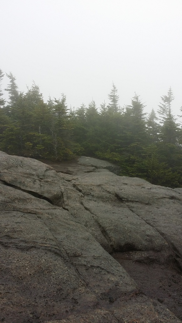
My 5th high peak occurred at 9:15am on that July morning, 5.5 miles from my car, all alone and quiet, with no views to speak of due to trees and clouds. I was amazed to discover that, despite having just climbed nearly 3,000 feet and covering nearly 6 miles, I felt fresh, and the struggle and fatigue I had felt earlier in the climb had not grown, but actually faded. I felt energized and ready to tackle the next one.

From the summit of Lower Wolfjaw
Looking at what’s to come while descending Lower Wolfjaw

Back down I bounded, reaching the bottom of the notch in short order. The climb out of the other side of the notch to Upper Wolfjaw is a bit longer, and even more rugged. I laughed at the playground of obstacle after obstacle, my pace becoming a crawl. This was definitely a step up from anything I had encountered before. Reaching the false summit, a short reprieve was enjoyed, but then it was back down and another steep climb up to the actual summit. A small side trail lead to a giant rock, which I could only assume was the high point. It was 11am and already I had two more high peaks under my belt. I was dancing with the mountains, and I wanted more.

From the summit of Upper Wolfjaw
Looking back from where I came at Lower Wolfjaw and the false peak of Upper Wolfjaw. The gap between them is the notch and the reason for its name.
Heading down Upper Wolfjaw towards Armstrong. Saddleback is visible in the distance to the right.

Reaching the col between Upper Wolfjaw and Armstrong, my concept of “rugged” was challenged yet again. This was getting serious. I walked 20 feet, climbed straight up for 20 feet, walked 20 feet, climbed straight up for 20 feet, over and over again. I was really glad I had worked so hard to get my upper body in shape, as I was using it more than my legs at this point. I was also quite cognizant of how much my height was helping me scale these short cliffs. I have no idea how shorter people manage this section, but kudos to them.

Thankful for a ladder on a section of Armstrong
The fun didn’t stop at the top of the ladder
And still more fun ahead, too

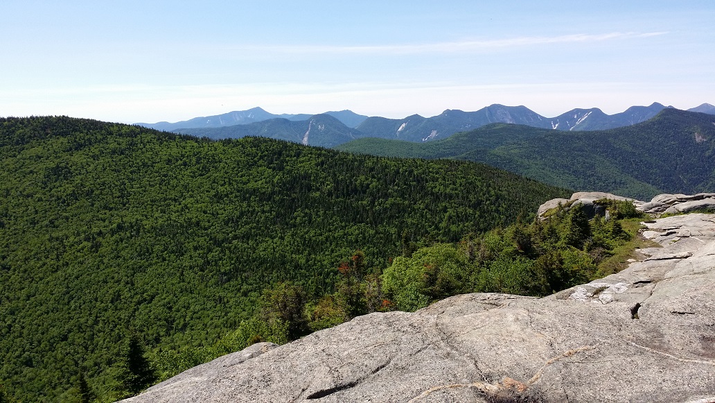
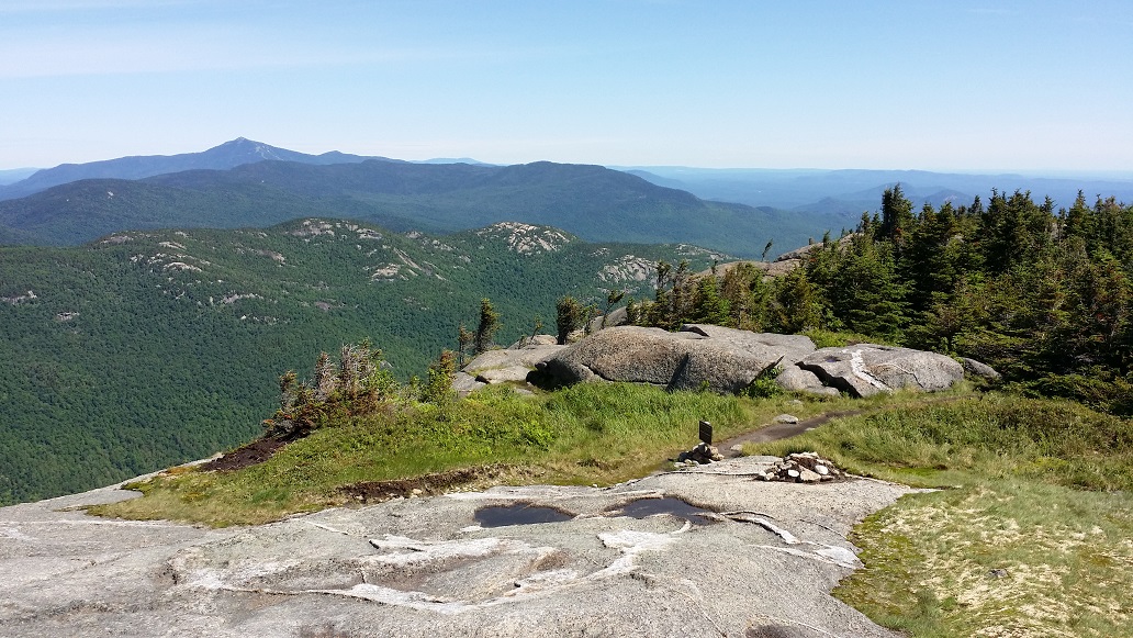
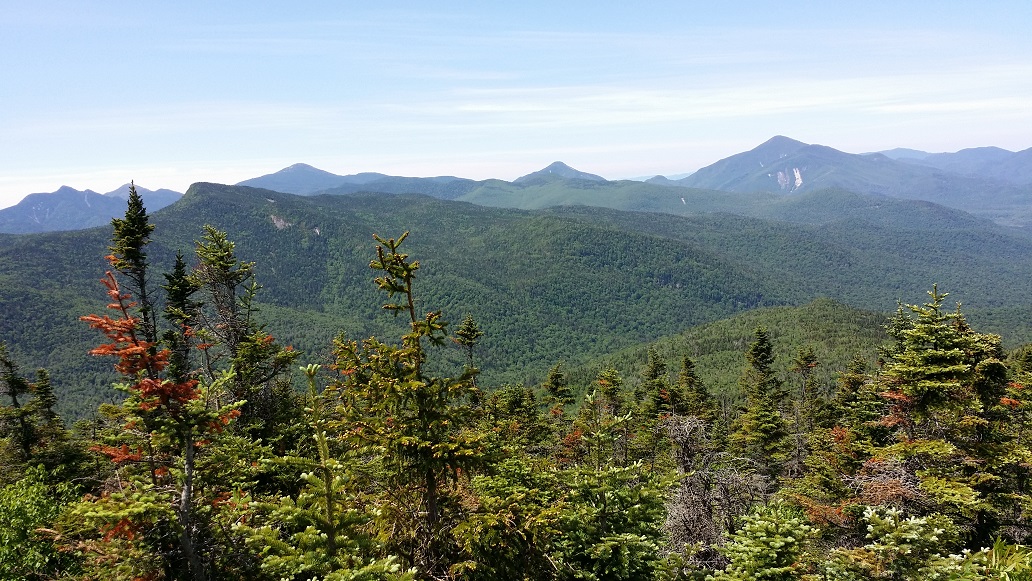
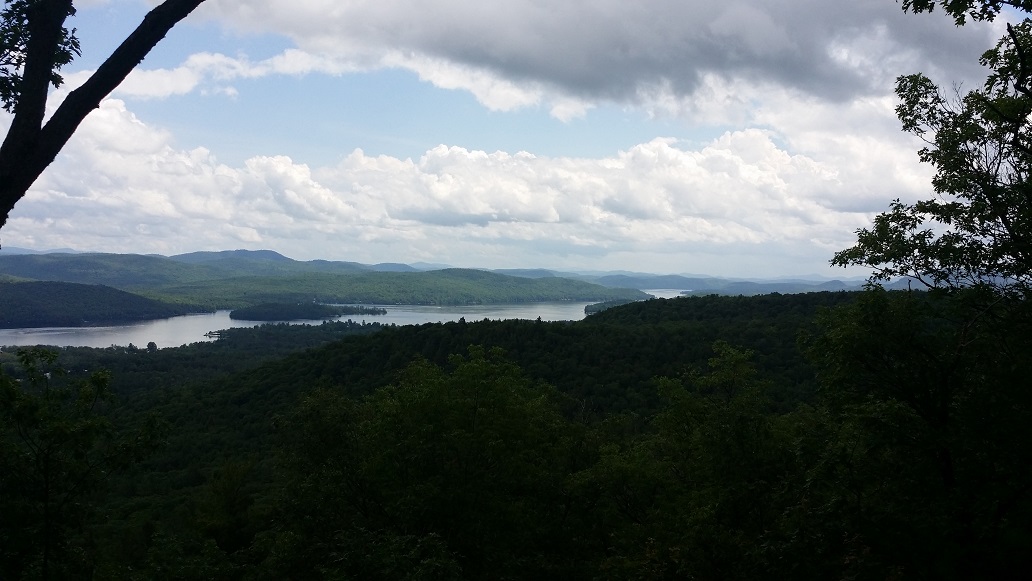
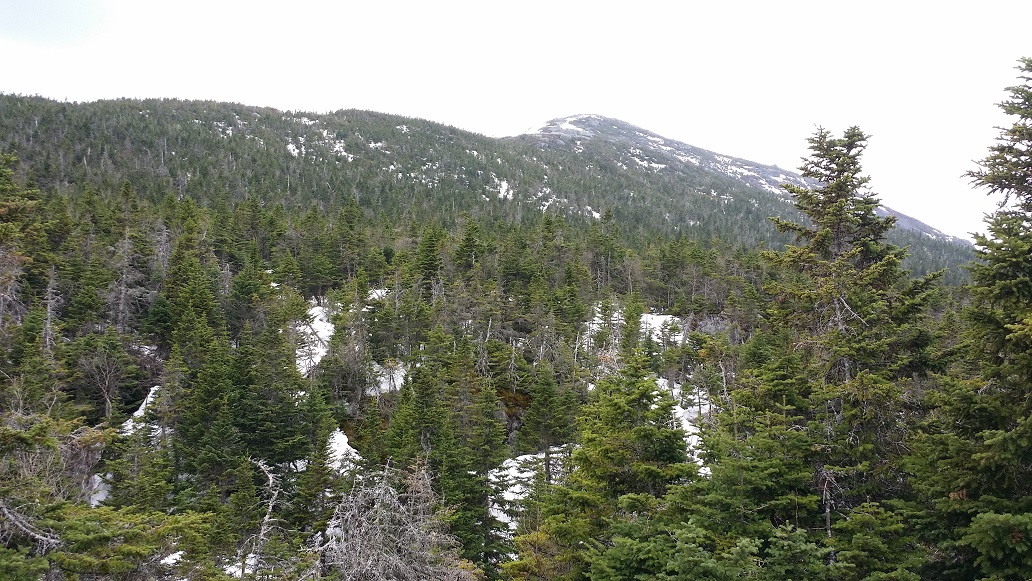
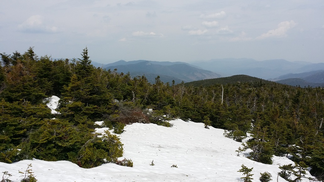
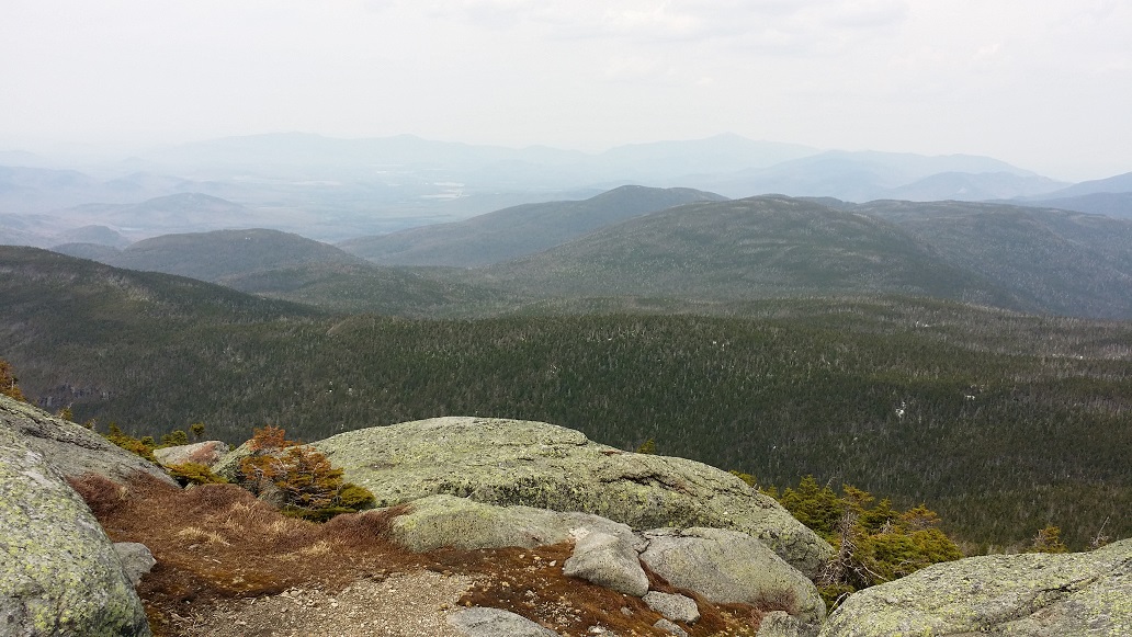
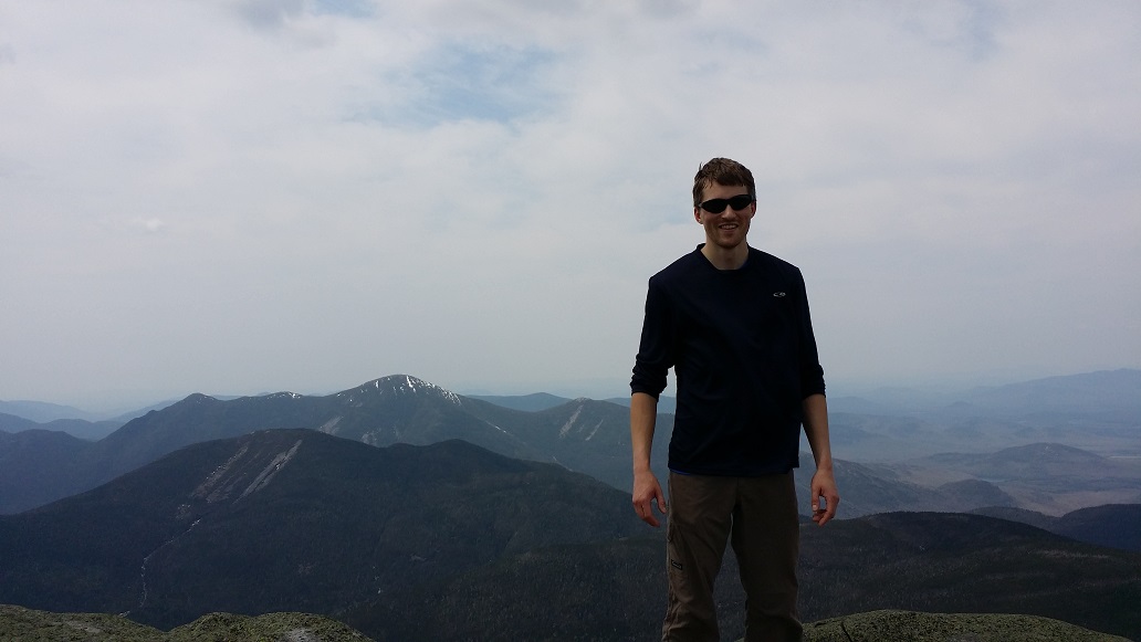
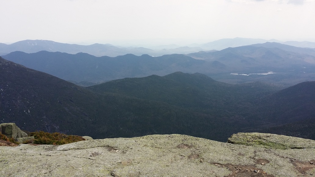
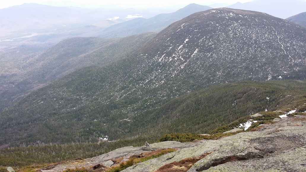
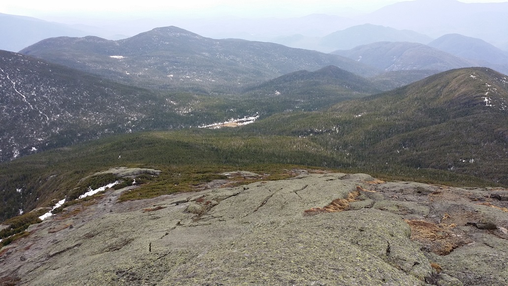
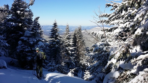
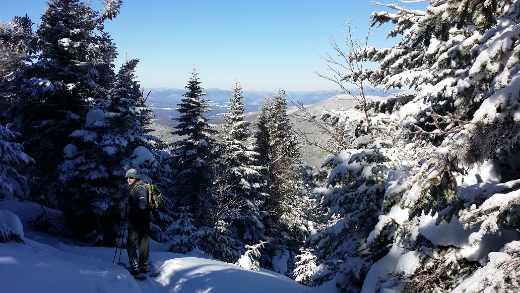
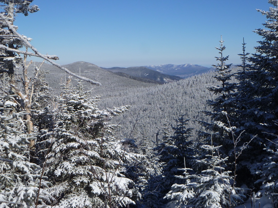
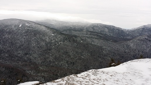
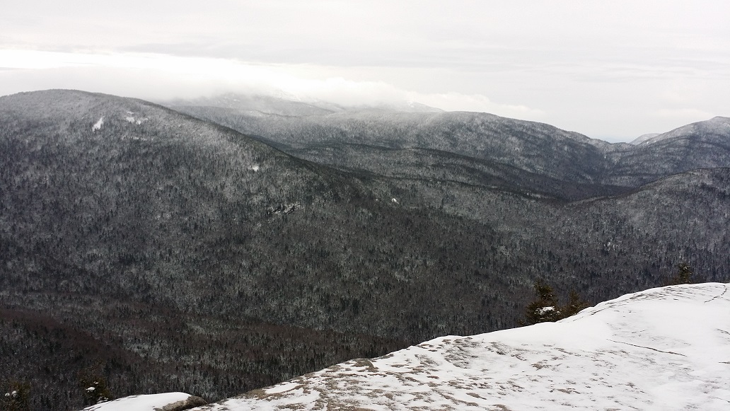
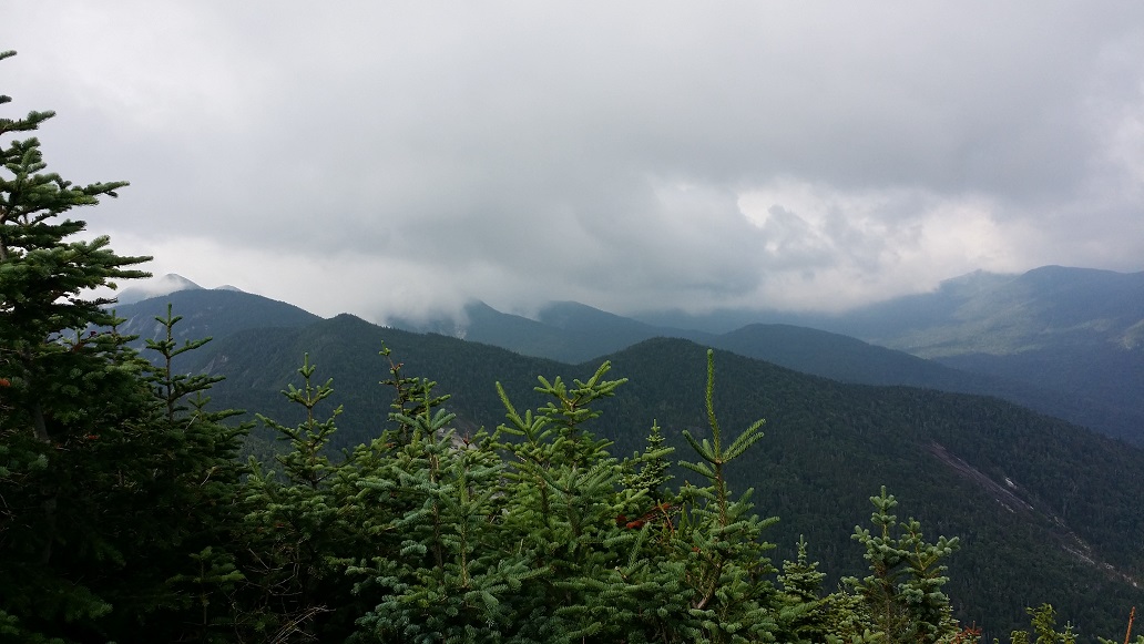
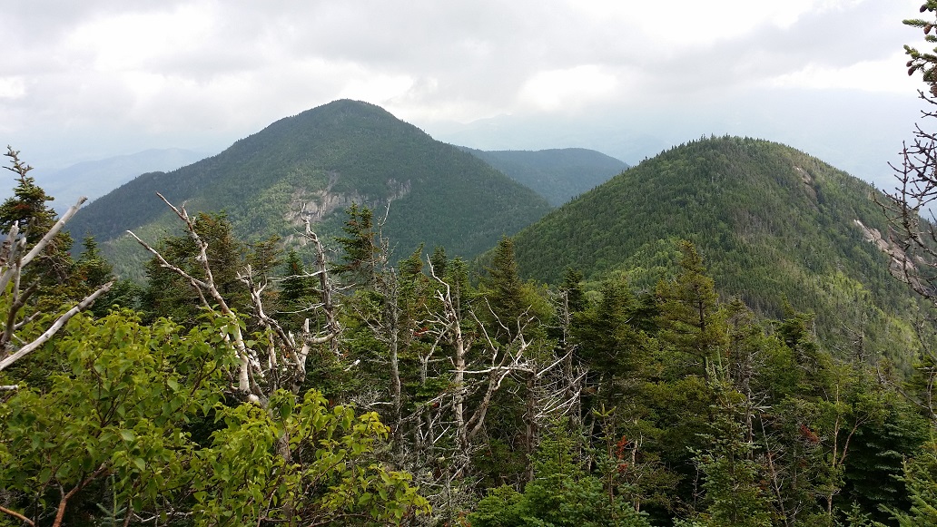
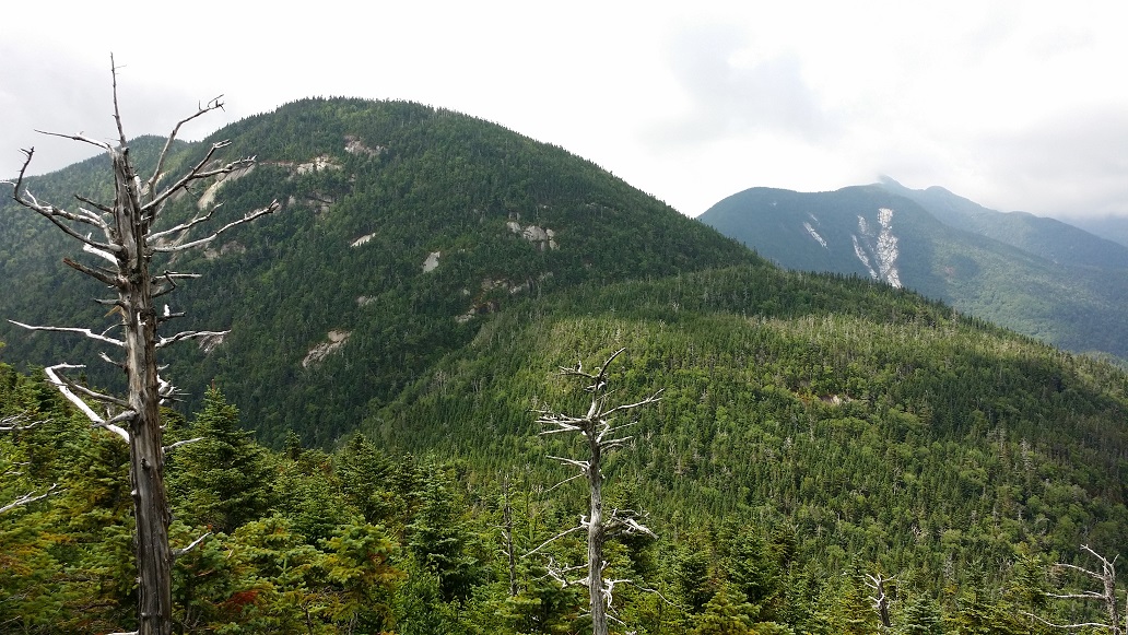
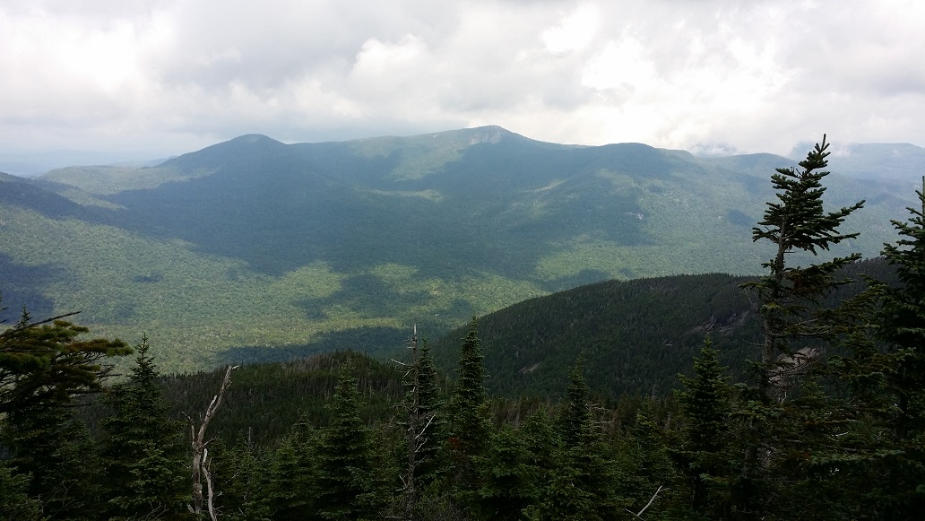
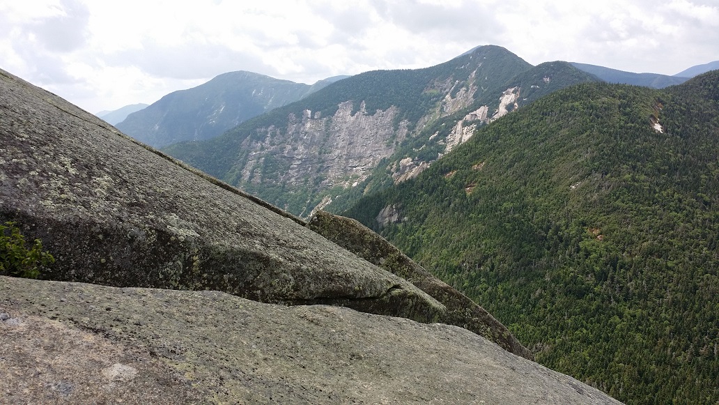
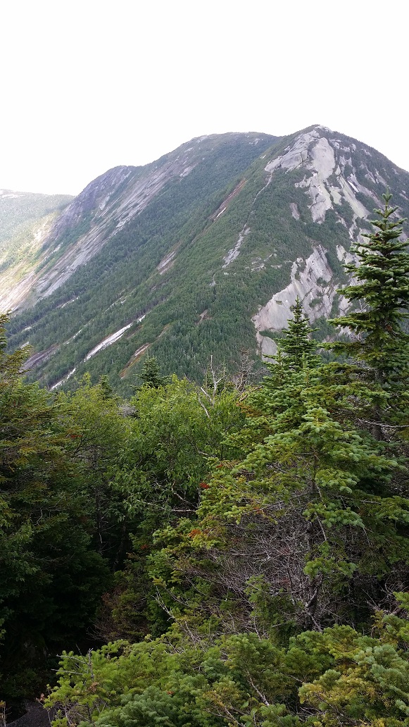
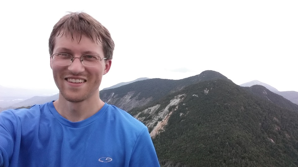
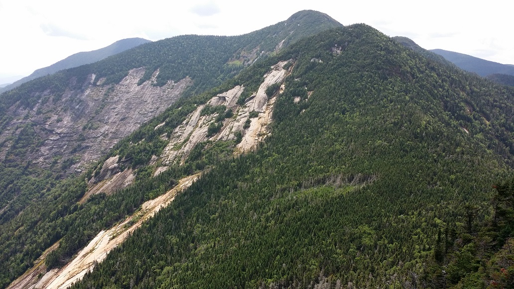
An hour later I stumbled out onto the cliffs of the summit of Armstrong, thankful that section was behind me, and hopeful I wouldn’t have to return that way. To avoid a return trip, I would at least have to summit one more, Gothics, and descend via its cable route. But for now, the clouds were swirling their way over and out of the peaks, leaving behind absolutely breathtaking views of the rest of the Great Range, and I took in my 7th high peak summit experience.

Armstrong summit shot, flanked by Gothics, Saddleback, and Basin
Big Slide from the summit of Armstrong. JBL is the dot way down in the valley.

A Canadian man was finishing up his lunch on the summit. He was the first person I had encountered since the pair halfway up Wolfjaws Notch several hours earlier, and it was good to have some company for a bit. He had just climbed the same section with a full overnight pack. I was astounded that was even possible. He was a very experienced backpacker, out for several days mountain hopping, finding places between them to bed down at night. I found him inspiring, and he strongly encouraged me to make it all the way to Haystack, the last mountain in the range, that day. I scoffed, quite certain that was beyond what I had in me, especially since I planned to drive the 4 hours home afterward. But it certainly was intriguing.

After having a bit of food myself and chatting for a while, I decided to head off in the direction of Gothics. He was about to depart the same way, so I waved and said, “See you on the next one!” and took off. The descent down Armstrong was far easier than the ascent up the other side, and shortly I came to a trail junction at the base of the col. A young man was there taking a break, drinking from a water bottle with a Sawyer filter attached, having just climbed up from the east side. Gothics is a destination mountain many people do by itself, and the trail that comes up to this junction from the Adirondack Mountain Reserve (AMR) land is reputedly the easiest route. As such it is more heavily traveled, and even while chatting there for a few minutes, more people came up, huffing and puffing, having just completed the majority of the climb. Not wanting to mill about in a crowd after having been alone all morning, I moved on.

Heading down Armstrong, looking back up at Gothics, with Pyramid Peak to the left
Bog in the col between Armstrong and Gothics

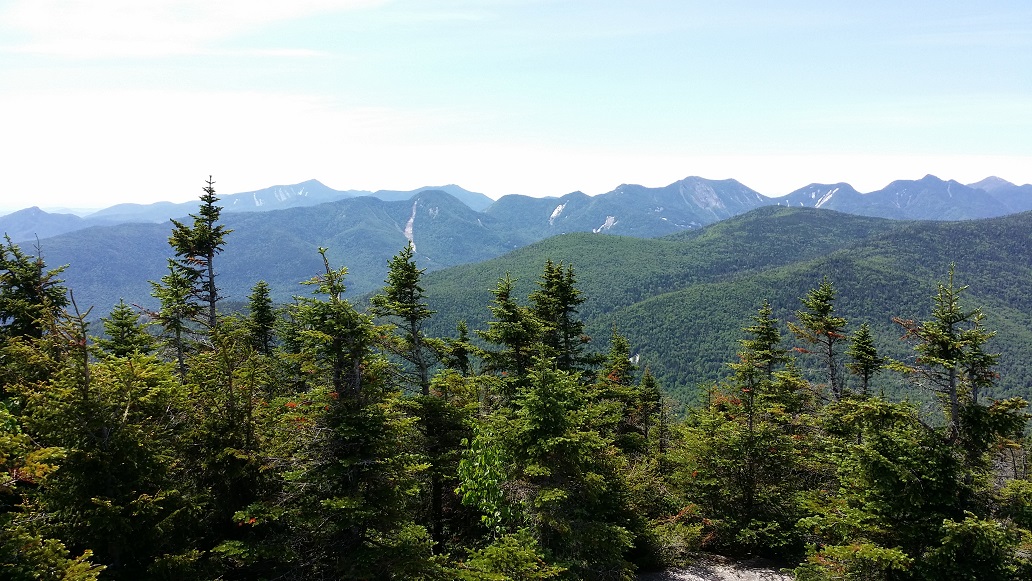
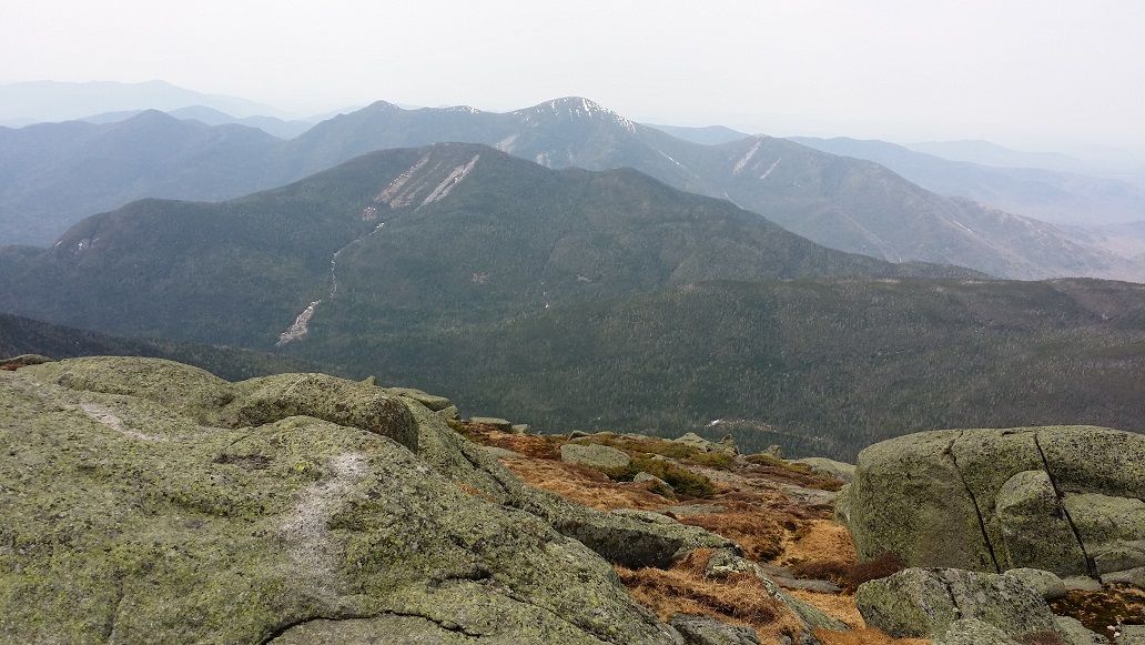
The climb up Gothics out of the col was quite easy. In no time at all, somewhat in disbelief after the struggles earlier on Upper Wolfjaw and Armstrong, I found myself on the summit. It was 1pm, and I had just completed my 4th high peak of the day, doubling my total. And Gothics is an impressive one. Ranked 10th in the state at 4,736 feet, it has sheer drops on both sides and 360 degree views from right in the heart of the High Peaks region. I sat down to breathe it in and have a snack.

Gothics geological survey bench mark
From the summit of Gothics, looking down the rest of the Great Range at its subpeak, Saddleback, Basin, Haystack, and Marcy poking up above all the rest

There was only one other person on the summit when I arrived. Within a few minutes more arrived, and then more, and more. My Canadian friend also came along as I was getting ready to head out. I smiled and greeted him. We studied the map together, and he asked, “So, how far are you going to go?” I responded, “I’m still not sure. I guess I’ll just play it by ear.” I was still feeling pretty good. Astoundingly so, really. I had been popping a few ibuprofen throughout the day, and my energy levels still felt high, and aches and pains low. But I was also weary of the time. It was now after 1pm, and Zebra Supervan, ever patiently awaiting my return, was a very long way away. I figured I would descend down off Gothics to the next trail junction in the col, and then decide whether it was time to head out, or if I wanted to make a run at the next mountain, Saddleback.

Gothics has a false summit to the south, the direction I was heading. The trek between them is easy and quick. I passed a man heading in the opposite direction toward the actual summit. He asked, “Is this the way to the summit?” “Yup, you’re almost there,” I replied. He said, “OK, I thought so. There are two women back there who I could not convince they weren’t on the real summit.” I laughed and went on to see what I could do. A few minutes later, rounding a bend, the trail came to the cliffs on the false summit. On the cliffs were two of the most beautiful women I had ever seen, lying on the rocks, sunning themselves. Immediately they asked if this was the real summit. I said, no, I had just come from the real one. They were so exhausted from having just climbed up the cable route that they weren’t convinced it was worth the effort. I reassured them it was an easy 10 minute walk, and they had already come all this way with the hard part behind them. I never did find out if they did it in the end. At least meeting them gave my mind something to do during the rest of my hike.

Upper Ausable Lake from the Gothics subpeak
Starting the descent of the cable route, looking up across Saddleback, Basin, and Haystack

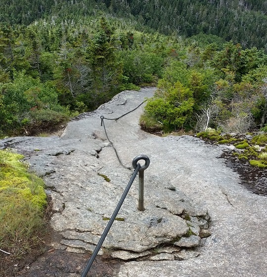
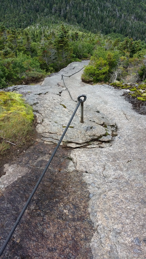
Off I went to discover what the cable route was all about and get myself down off this mammoth mountain. I wasn’t particularly concerned about it. I have  always enjoyed a bit of technical climbing, and figured as long as I had a cable to hold onto, I’d be fine. But at the top, there is no cable. I found myself on the precipice of a thousand foot sheer drop. I gently lowered myself down section by section, exposed to an extent where a slip would mean certain disaster and death. One slip and there would be no stopping the fall. Gingerly I descended, my heart racing faster than it had during any of the ascents. Mercifully, I came upon the start of the cable, a thick black piece of rubber running down the side of the mountain through giant metal eye hooks drilled into the rock face. Quickly I lowered myself down, grateful for the extra support, always having one hand on the cable.

50 feet gingerly down, several hundred more to go
The cable

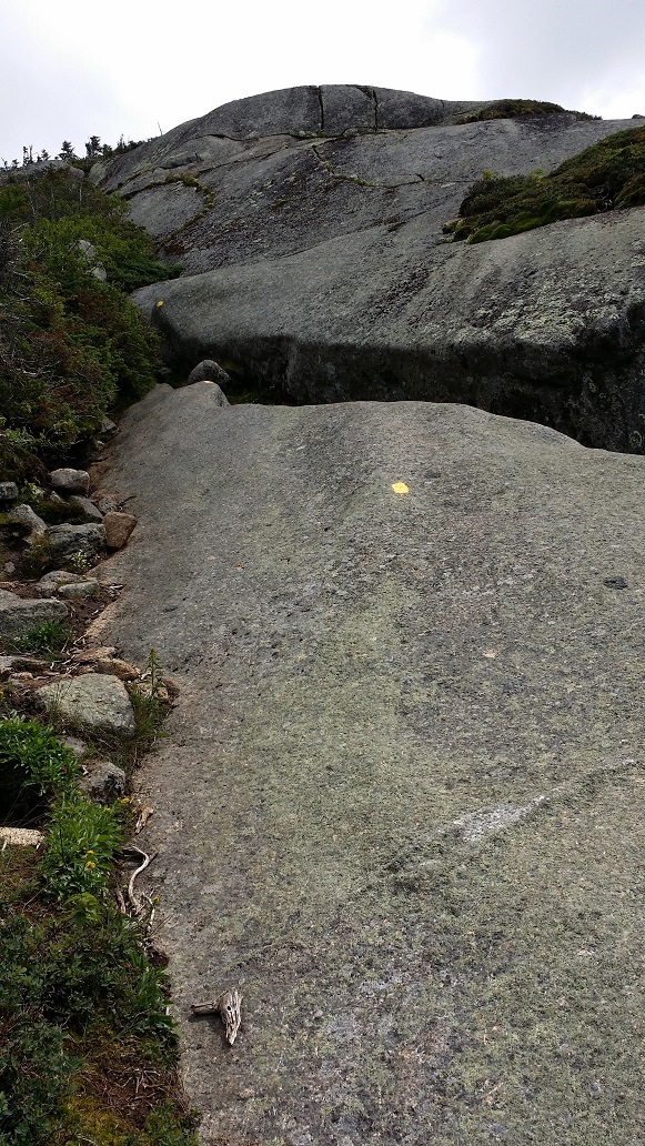
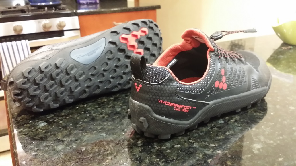
When the cable ended, the path was still steep, but marginally less so, and the scrub brush lining the trail was getting taller and thicker. I started walking down, upright, feeling more confident now. Pride goeth before a fall. I should have thought of that before my foot slipped. My hand reflexively shot out to the side and grabbed some scrub brush, stabilizing myself and staving off a worse fate. My shoes had nubs on the soles made for traction in mud. It turns out they are not so good for smooth bare rock. As I stood still and waited for my heart to return to its normal position and tempo in my chest, I decided it would be best to crab walk the remainder of the descent.

And so on I went, down on all fours, belly up and feet first, for the remainder of the notorious Gothics cable route. Finally hitting the base of the col at the next trail junction, it was decision time. The trail sign said Saddleback was only a half mile away. But the drain from the day was beginning to bare its teeth. But what’s another half mile after all I’d done? And it would mean 5 peaks in one day. I decided to go for it, and then I could decide whether to backtrack down to this junction and head out, or maybe even be crazy enough to go after number 6.

From the side of Saddleback, looking back at Gothics. The cable route is visible, cut into the scrub. The top exposed section was the most knee shaking.

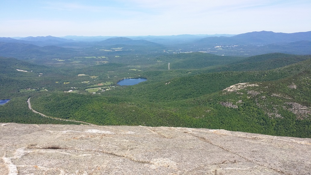
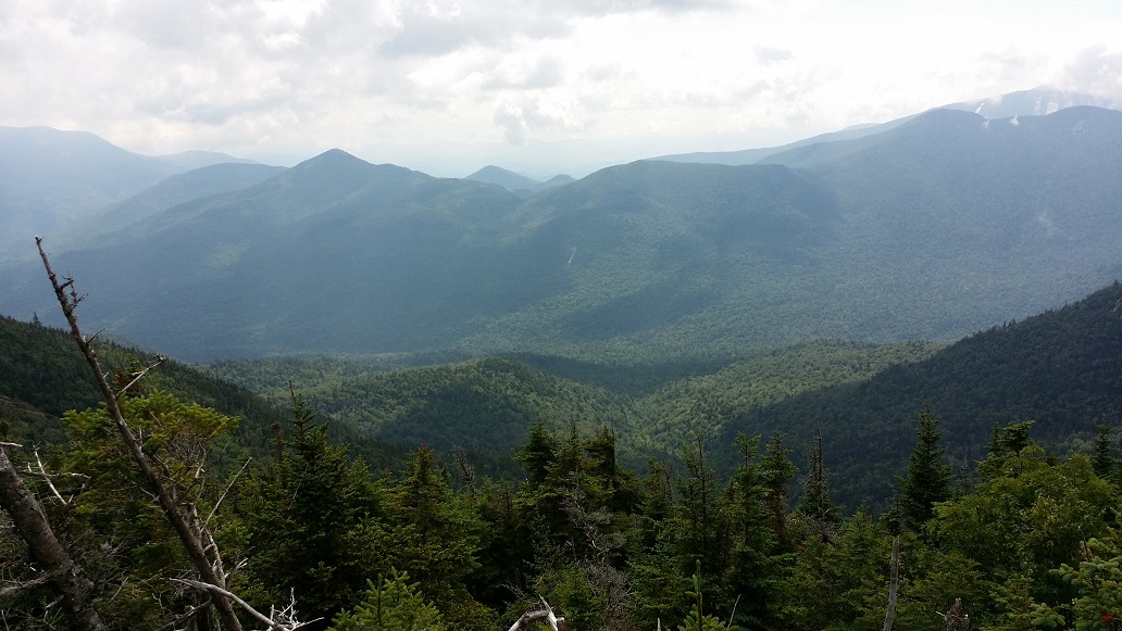
The half mile up Saddleback was pretty rugged, but nothing as bad as what I had already done, and went uneventfully. It’s a steep climb for the first half, and then the second half goes over and across the saddle to the other side where the Saddleback cliffs are, and the actual summit. My 9th high peak occurred at 2:45 that afternoon, the 5th of the day. I could not have been happier. But it was getting late, and I had 7.5 miles to return. I sat down on the cliff’s edge to take in the views of Basin and Haystack before me, and had a bite to eat. It was so quiet and still that I could hear the chatter of a group several hundred feet below me and a half mile away crossing the col.

Exhausted, but so happy
From the cliffs on the summit of Saddleback, a look across at Basin
Upper Ausable Lake and the Colvin Range from Saddleback

It became clear to me that I was done. This was my turn-around point. Time and energy reserves made it obvious that continuing farther out away from my car would not be a wise choice. So after resting for 10 minutes, I got up to leave. Pain instantly shot down the back of my right knee, stiffening the joint. It didn’t feel like the normal arthritic pain I was used to, but I popped a few more ibuprofen anyway and limbered about trying to loosen it up. My mind raced, wondering how I was going to do the descent like this, and cursing myself. What kind of moron goes searching for his body’s limit and trips flat-faced over it? Oh, there it is! Now what? Now you get yourself down the mountain, dumbass.

Hobbling back across the saddle, I dreaded the descent to come. Thankfully the flat section seemed to help loosen the knee up some, and I picked my way back down, crab walking again at times, all the way to the junction. From the junction, it heads steeply down the Orebed Brook Trail. More crab walking. Crab walking forever. I’d estimate I crab walked close to a mile in total. Or at least so my hands claim.

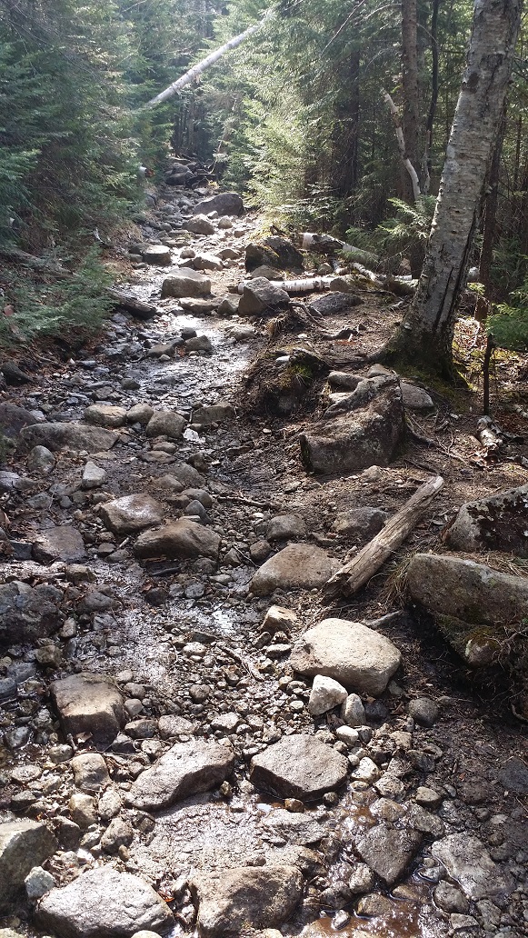
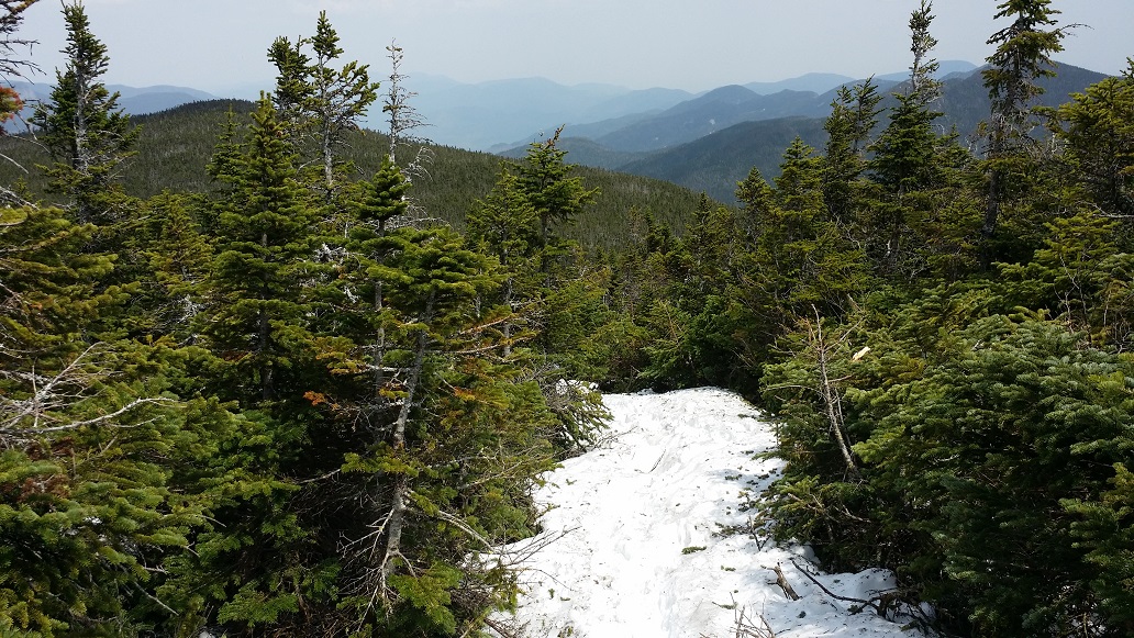
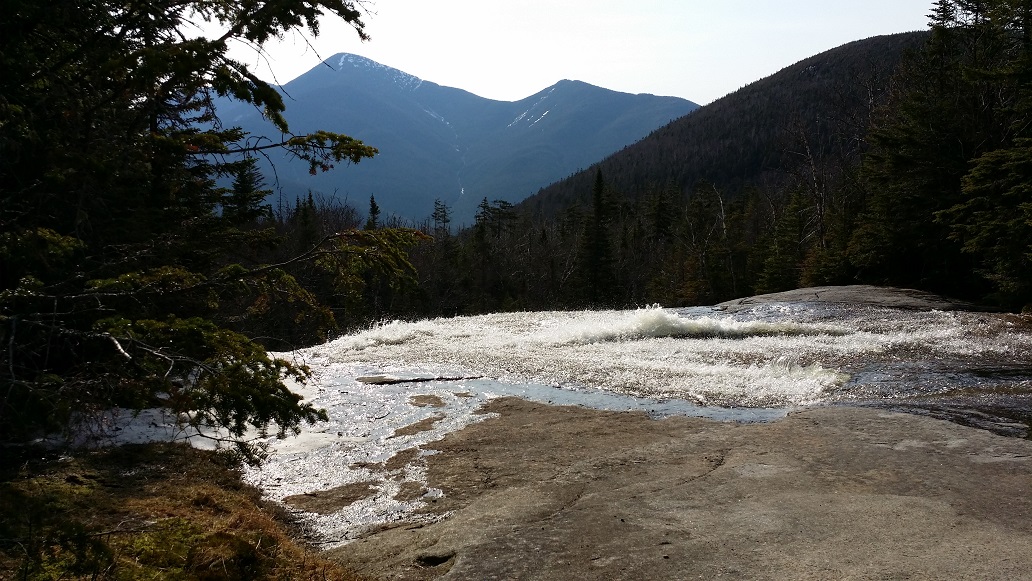
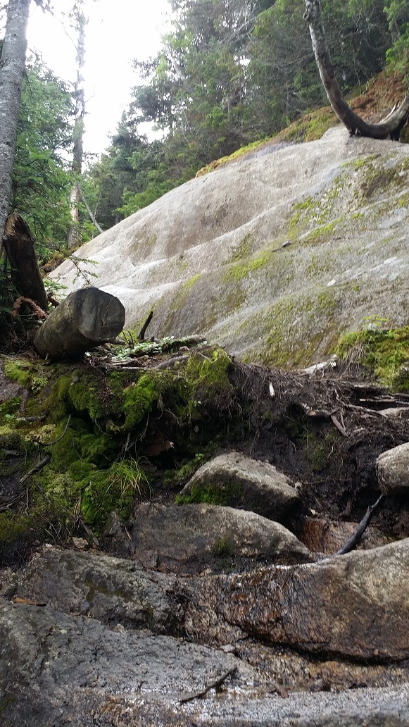
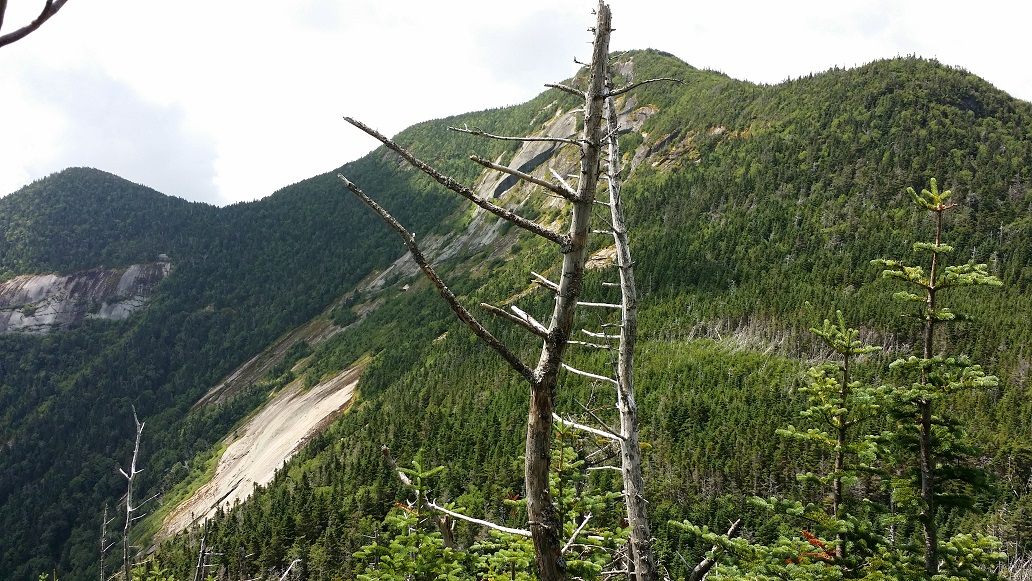
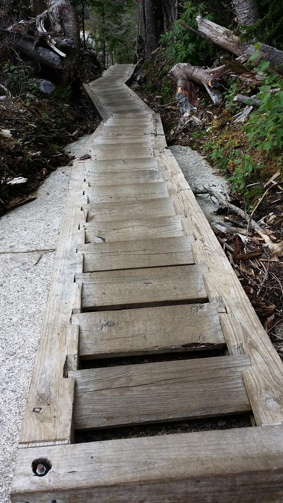
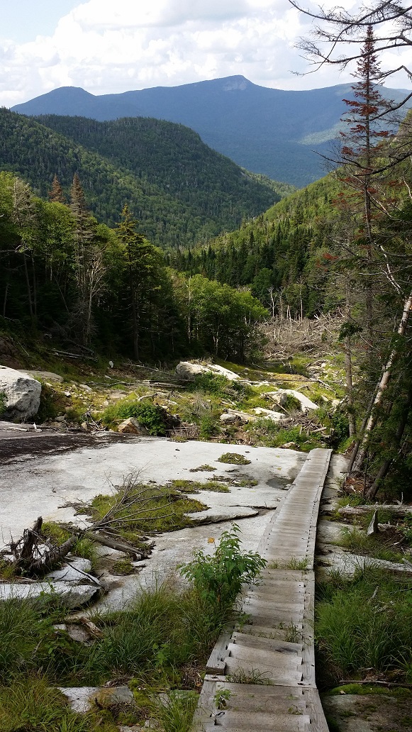
Still more than 6 miles from the parking lot, the trail, an eroded combination of fallen branches, mud, and bare rock, broke out from the trees onto a different planet altogether. The Orebed Brook slide is a vast swath of bare bright white rock, in the middle of nowhere. It stopped me in my tracks. I had never experienced anything quite like it. And this wasn’t a scar from the hand of man, but another example of the power of water in these mountains. I worked my way down the slide, looking for cairns and the yellow painted blaze markers. And then I came to something even more unexpected. Stairs. Stairs that went on and on and on, beyond what I could even see. Quickly I descended, down, down, down, noting by the spike marks in the wood how these stairs probably come in quite handy in the winter. Also, I thought of the builders of these stairs, carving out the braces, cutting the steps, drilling them into the rock, countless flights, miles from anywhere.

The Orebed Brook slide
Stairs drilled into the slide rock go on forever

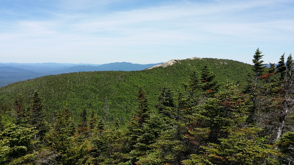
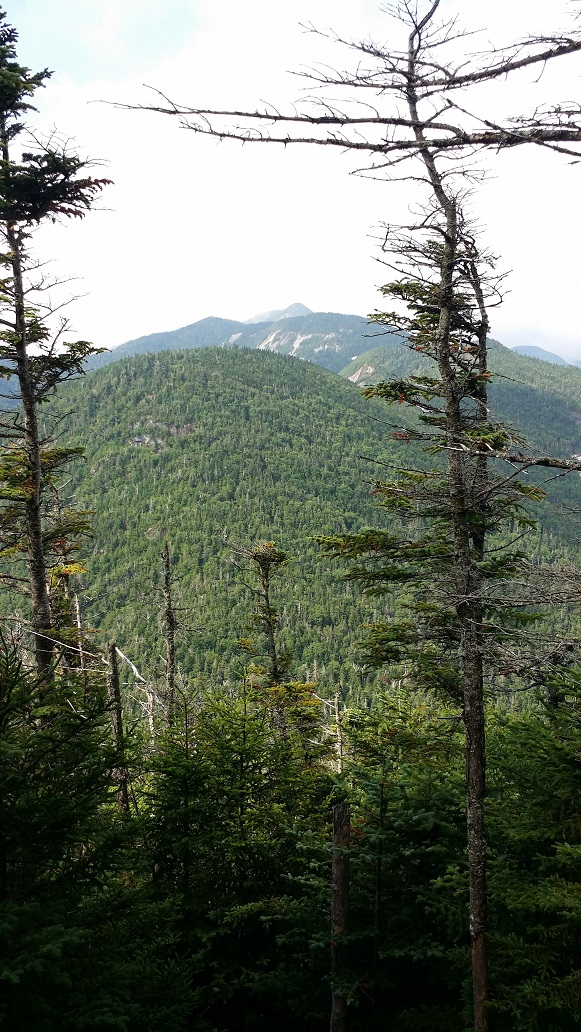
Finally reaching the last of the steps, I paused and looked up. Immediately before me, at the bottom of the slide, was an unfathomable pile of trees, washed down like a jumble of matchsticks. Towering above was another high peak, Big Slide. I felt both lost and found in the wilderness all at once, alone on the planet, yet at home. The trail made a sharp right, and I dove back into the woods.

The stairs finally end where storm waters have piled full size trees like a jumble of matchsticks. Big Slide is in the distance.

A new dilemma was becoming increasingly urgent. It had been a long, hot summer day, and I had been working hard and sweating profusely for most of it. The 3 bottles of water I brought had been emptied, and I was getting thirsty. Once up on the Great Range Trail, being at the high point of the ridge all day, I hadn’t encountered a single spot to fill up. I knew I should be hitting the brook soon and this far down it should be enough to filter from. The problem was that my knee felt a bit better as long as I kept moving, and I feared a stop to refill would cause another lock-up. Of course, becoming severely dehydrated was a worse fate, so as soon as I encountered a good spot in the stream I made a pit stop to get out my filter.

The aptly named Orebed Brook

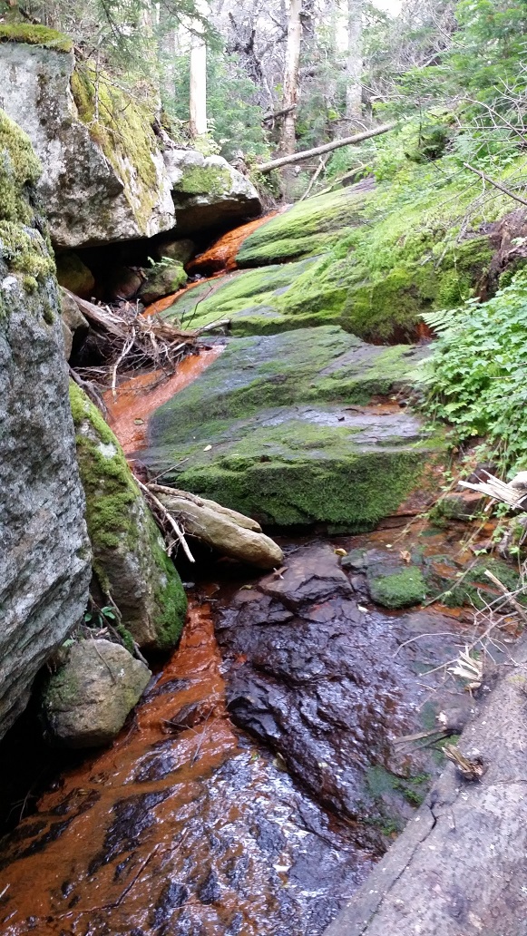
The water was rust colored, but I figured the filter would remove anything dangerous, and if I got a little extra iron in my diet, all the better. Not wanting to stop for too long, I only filled up 2 of the 3 bottles, and then got moving again. I was happy to discover that my knee stayed relatively loose, and I quickly hobbled on.

All day I had been hopping from peak to peak, obstacle to obstacle, junction to junction. It was great fun, and kept the journey lively and interesting. Now in this section of trail, it became a gradual and easy descent, and I was able to find my rhythm. My mind quieted and it became meditative. My hiking poles became another set of legs, my eyes automatically scoped the rocks, trees, and mud before me, and my body mindlessly navigated them with an ease I had never known before. The miles ticked by, and I was able to just breathe it all in, the ground effortlessly rolling under me. This was what my body was designed for, an off-road vehicle of incredible efficiency capable of covering any terrain for any distance. This was pure joy. This was hiking.

Occasionally my mind would drift to finding the two women cooling off in one of the many streams I crossed, but alas, such situations are better left to fantasy anyway. I did pass a lean-to with a gaggle of hikers settling in for the evening and enjoying joyful conversations. It momentarily brought me back to reality and I thought, this would be a great spot to spend a night some time. Not on a weekend. Too people-y.

I came upon the junction to cross Johns Brook over to the lodge, and slowly began to awaken from my dream. Signs marked the start of the ADK property, which owns and operates JBL. A couple chatted and laughed, cuddling inside the cocoon of a hammock hung over the bubbling brook. Shortly I broke out from the bushes and saw the lodge for the first time up close, entertained by the thought that I had seen the green roof as a tiny dot from thousands of feet above and miles away many hours earlier.

Johns Brook Lodge

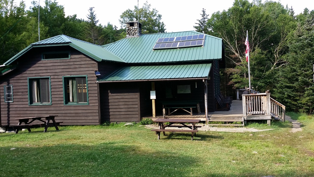
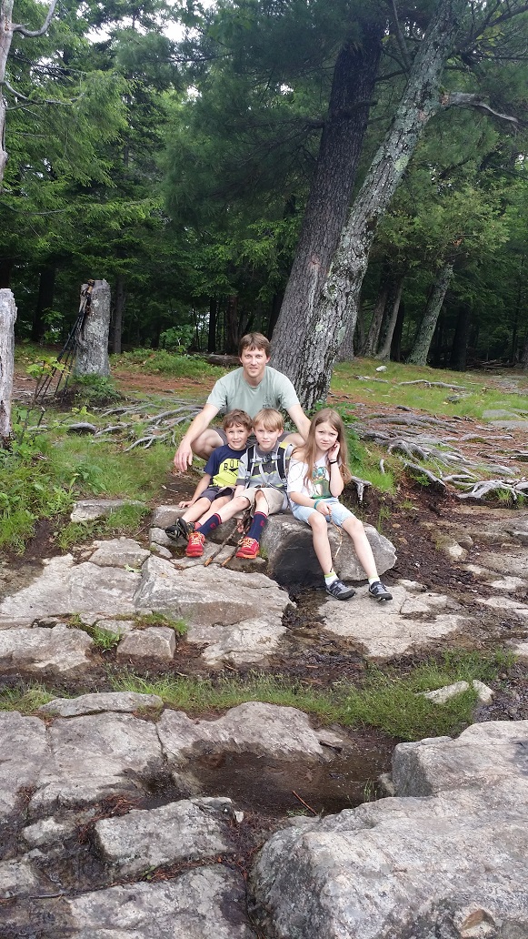
People. So many people. There were probably only 10 or 20, but their voices drifted into my ears from every angle. It felt so strange after having been alone for most of the day. Becoming a tad overwhelmed, I only paused to grab a picture before moving on, ready to tackle the final 3.5 miles.

My knee continued to twinge on the way out, but as long as I kept moving it was pretty minor, and I was largely able to meditate my way through it once again. I did have one brief but memorable chat with an older couple on their way in to camp for the night. He had recently undergone knee surgery, and his joy and gratitude to be out there hiking again, enjoying this incredible wilderness, was bubbling over. I could relate.

Four years prior to this hike I could barely walk due to severe arthritis, and I had just completed a hike I never would have thought possible, before or after my episode, and it had permitted me to see and experience things beyond my imagination. I had left my house only 24 hours earlier, and felt like I had journeyed all the way around the world and back. I was a different man. My self-imposed limitations had been shoved way the hell out. I would never look at myself or hiking the same way again.

Arriving back to my car just before 6pm, I removed my shoes, socks, and shirt. I didn’t know bodies could smell like that. I didn’t know feet could look like that. I was not thrilled by the prospect of spending the next four hours locked up in a car with myself, but had little choice. The bright side of sitting down was I discovered the knee pain disappeared.

It was around Albany that what I had done really hit me. The endorphins and blasting music inflated my chest to the bursting point, and I screamed, “Fuck yeah! Fuuuuuucccccckkkkkk yeeeeeeeaaaaaahhhhhhh!!!!” With that out of the way, all I could do was grin from ear to ear. I had done it. I had not only overcome my fears, but had even surpassed what I thought possible. 17 miles and 5,000 feet vertical on some of the most notoriously rugged trails in the Northeast. 5 peaks, bringing my total from 4 all the way to 9 on my journey to the 46. It wasn’t without its difficulties, but it had gone shockingly well, and I had learned and experienced so much.

And then there was hunger. So much hunger. As the endorphins faded and the fatigue began to settle over me, all I could think of was food. I decided I’d pick up some take-out on my way into town, not having anything substantial and quick to eat at home (another lesson learned – plan ahead!). So I asked Google what time various places around my house closed. But it was Sunday night, and everything closed at 10. I wouldn’t be arriving until well after that.

It was 10:30pm when I hobbled and creaked my way into Wegmans, covered in mud within a cloud of my own stink. I felt like the bog monster creeping out of the woods to frighten civilized damsels. Thankfully it was largely empty, and I quickly grabbed a steak and a bag of frozen french fries. I paid, averting my eyes from the cashier to avoid my own embarrassment, and finally went home.

A shower never felt so cleansing. Food never tasted so replenishing and delicious. And my bed never felt so warm and welcoming. It was 1am as I drifted off to sleep, a changed man after 31 of the most epic hours of my life.

Father’s Day 2015

Hike: Cascade and Porter Mountains
Distance: ~6.5 miles
Elevation: 4098 ft (Cascade) 4059 ft (Porter)
Total Ascent: ~2300 ft
Date: June 20, 2015

Discussions of a return trip to Cascade and Porter had been ongoing for some time between my brother Brian and I. He had been up Cascade a decade earlier, but had not caught Porter at the time. I had been up both 8 months prior, but the weather had prevented seeing any views. And so it worked out that we could gather on Father’s Day weekend to resolve these issues.

The plan was to make a quick trip to grab them on Saturday, and then do a shorter, less rushed hike with my dad and kids Sunday. We arrived a bit late at the trailhead, and were worried about finding a parking spot. However, we lucked out because someone had just pulled out right next to it. While we were getting ready to kick off, a small car attempted to park on the other side of the street and went in a bit far, until only 3 wheels were on the ground. I was about to run across and jump on his trunk, but thankfully he was able to back up and get the fourth back down.

Stream Crossing on Cascade Trail

The hike up Cascade went fairly quickly and smoothly. We both felt like we were in pretty good shape after our Marcy summit a month prior, so we were excited to see how this went. Before we knew it we were on the last push above treeline.

Summiting CascadeThe ADK has a summit steward program which posts a person on many of the more popular High Peak summits during the summer months. They are there to educate hikers and keep them off the fragile plants that grow there. A very kind and knowledgeable young woman was posted on Cascade this day, and took our picture (the other, unofficial, duty of stewards). It’s one of my favorite pictures of us.

Brian and I on CascadeWe were fortunate to summit during a lull, and spent quite a while chatting and enjoying the views.

Dix, The Great Range, Big Slide over Porter from Cascade
Dix, The Great Range, Big Slide over Porter
Marcy, Colden, Algonquin, etc etc
Facing East over Round Lake from Cascade
Facing East over Round Lake
Facing North over Pitchoff and Whiteface from Cascade
Facing North over Pitchoff and Whiteface

Feeling good, we hauled ass off Cascade back to the junction for Porter. There is a semi-technical descent for part of the 0.75 miles out to Porter. We passed a pair of women, one with a young child on her back, who was a 46er multiple times over. Climbing back up to Porter’s summit, the ascending fatigue returned and I slowed down. I still hadn’t achieved my climbing legs.

My Non-Beach Legs
My Non-Beach Legs
Porter
Porter

The summit of Porter is treed in, but it turns out there are still pretty good views over the tree tops.

Cascade from Porter
Cascade from Porter
The Great Range from Porter
The Great Range
Big Slide, Marcy, Colden, Algonquin from Porter
Big Slide, Marcy, Colden, Algonquin

Hike: Mt Severance
Distance: 2.4 miles
Elevation: 1693 ft
Total Ascent: ~800 ft
Date: June 21, 2015

Sunday, Father’s Day, started with a nice motivating tantrum from my youngest. Clearly it was time to get into the woods. My children were not particularly interested, but I wanted them all to at least get a taste of the experience, and Mt Severance is a short climb with rewarding views, so it fit the bill.

The trail starts by literally tunneling under Interstate 87, followed by crossing some bridges over a bog area. Then the trail gets pretty easy, with very gradual climbing.

Kids Are Off!
Kids Are Off!
Jenks Men
Jenks Men

There are a few fun stops along the way, such as this giant rock.

Giant Rock

King of the Mountain

Having become used to longer, taller hikes, it was a surprise when we came to the summit. Not to the kids, however. My daughter, especially, was not particularly enjoying the experience. She now says she’s happy to have a helicopter drop her on top and she’d be willing to walk down.

Happy Father's Day
Happy Father’s Day
Schroon Lake from Mt Severance
Schroon Lake

Return to Marcy

Hike: Mount Marcy
Distance: 15 miles
Elevation: 5344 ft
Total Ascent: ~3800 ft
Date: May 9, 2015

To say I had become a little obsessed with standing on top of Mount Marcy after our epic failure (er, solid attempt! … learning experience?) back in January would be the understatement of the year. Unfortunately life and poor Spring hiking conditions disrupted the flow, and the next opportunity wouldn’t come for several months.

I was itching to try out my new shoes. I had spent months agonizing over what to slip my feet into once winter took its leave. I wanted minimalist shoes, but waterproof and with decent traction in the mud. A tall order indeed. Once I gave up on the idea of finding a boot I was happy with and began looking at sneakers, I happened across the Vivobarefoot Winterproof Trail Freaks.

New Kicks
After 200+ miles, I still absolutely love these shoes. They are designed for all season trail running and are 100% waterproof, as long as you don’t dunk deeper than your ankle. (I’ve developed the tip-toe step through deeper water.) I’ve heard the second iteration of this line isn’t as well liked, though, so your mileage may vary.

An opportunity for a little getaway finally presented itself for me and my brother in May. I was telling some friends about my plans a few days before the trip. “I’m heading to my parents’ house (sans kids!) from tomorrow through Monday. Hoping to get a couple hikes in. Maybe even another Marcy attempt (apparently there is still a couple feet of snow up there).”

My friends were unimpressed. “Oooh. You found a May vacation spot with snow. You’re really winning at the vacation thing.”

Indeed, it was hard to imagine feet of snow anywhere at this point. Spring was in full swing, trees and flowers blooming, the grass already pissing me off because I JUST MOWED, DAMMIT. But Brian and I heeded the reports and packed our microspikes and snowshoes, even with the high temperature in the High Peaks expected to be around 80F.

I had also invested in a nice pair of Black Diamond trekking poles that I was excited to get to know. The value of good poles became apparent on the last hike when mine had become useless, contributing to my hip failure. I expected to fully use their features on this day, with rubber and carbide tips, and removable snow baskets.

We set off from the Loj up the now all-too-familiar Van Hoevenberg Trail around 8:30am, feeling relaxed and excited. It was already warm, and we had hours more daylight to play with. There would be no freezing to death today.

Brian Heading OutThe trail to Marcy Dam was surprisingly dry. This was supposed to be mud season! It turns out all the water was in Marcy Brook, overflowing the dam hard, melting off the surrounding mountains in torrents.

Marcy DamI was also provided with my first view of Wright Peak not draped in white. The air was warm, moist, and gloriously fragrant with Spring.

WrightWe passed some college-aged guys, also intending to summit Marcy. They were wearing shorts, t-shirts, and sneakers, with minimal gear on their backs. I felt a bit apprehensive while talking to them, knowing the conditions ahead would be far different than down below, but on we all went.

This was the first time I had seen this section of the trail along Phelps Brook not covered in thick ice. It turns out it’s far rockier and harder to traverse. But it was fine. A little sweat wasn’t going to slow us down too much.

Along Phelps BrookOnce across Phelps Brook, the trail begins to steepen quickly. This was our first sign that winter did still exist up here, however minor. It was important to carefully watch our step, as the difference between ice, rock, root, and mud was not always obvious.

Starting to See Some IceAround 3000 feet the patchy ice turned to consistent coverage. Most of it was only on the trail itself, the spine, from having been packed down by hikers and skiers over the previous months.

Getting Into the Snow

The thickness of the snow beneath us quickly grew as we climbed, even though the warm temperatures had it melting in buckets. We could literally hear the water rushing in rivers below our feet, finding its way down the mountain into Marcy Brook, over Marcy Dam, and eventually to Lake Champlain.

I had heard of postholing before, but never experienced it myself to this degree. If we were careful to step in the exact middle of the worn path, where others had packed it down well but hadn’t destabilized it by postholing themselves, then it was usually ok. A slight deviation would send us sinking to our hips. This happened, um, more than once. We passed a couple who were fleeing down in frustration, muttering about sinking every other step.

At one point, Brian put his pole in a hole I had just climbed out of to show its depth, and while doing so postholed himself. I had the pleasure of capturing the moment on camera.

Post-holingOne of the really cool things about this section of the hike was experiencing the battle between the cold and warm air. The ground and the sun were battling it out, and we were caught in the middle. A hot breeze would immediately be followed by an icy cold breeze, then hot breeze, etc.

Enjoying the Breeze
Image credit: Brian Jenks

Finally we made it to our turn-around point in January, feeling much stronger and more capable than back then, despite the battle with the unstable trail.

View from the Phelps Trail JunctionWe elected to continue on without our snowshoes. We received a few compliments at being the only ones on the mountain with the foresight to bring them, but that doesn’t mean we were smart enough to put them on our feet. One guy joked about wishing he had brought his raquettes, and another asked, “To play tennis?”, much to the delight of the rest of the group. It’s the little things.

View from Beyond the JunctionMuch of this section of trail was easier hiking. The snow pack was more stable, and we could trudge along without worrying about constantly postholing as much. It felt exciting to be further along than I had ever been before, seeing new trail that had been haunting my dreams for several months.

Crossing a Swamp Before TreelineIt’s often worth a look over your shoulder when climbing.

Looking Back on Little Marcy

Exiting the trees, the views immediately became phenomenal. This is looking down the Great Range with Basin in the forefront.

View of Basin from Treeline
Little Marcy with Big Slide in the Distance
Tabletop and Phelps
Tabletop and Phelps

Nearing the top, the snow was largely gone, but what was left was ice. There were a few tricky spots where the ice was unavoidable. At one point we refilled our bottles from water pouring off a little baby glacier, figuring there was little chance it would be contaminated at that location, since there was no upstream.

Patchy Ice on RockFinally, it was done. The summit of Mt Marcy. It was breathtaking, and we even had it to ourselves for a short while. We spent nearly an hour and a half relaxing, eating, and exploring.

Summit #4 Summit Marker

Although it was not a crystal clear day, the views were still impressive and well worth the trip.

Colvin Range
Colvin Range
Colden and the Macs
Colden and the Macs
Skylight
Skylight
Lake Tear of the Clouds
Lake Tear of the Clouds, the highest body of water in New York and the start of the mighty Hudson River.
Haystack
Haystack – Image credit: Brian Jenks

This is one of my favorite shots from the day, taken by my brother. It brings me back to that moment, standing atop Marcy and taking it all in. I was dreaming of exploring down there, beyond Marcy, experiencing Skylight, Lake Tear of the Clouds, Gray, Redfield, and Cliff from the west. It would be more than a year before that dream would become realized.

Taking in the View
Image credit: Brian Jenks

Finally around 3:30pm we decided we’d better get a move on, and started the long descent.

Following the Trail Down We took a break at Indian Falls. Marcy Brook was roaring, and there was a spotty cell phone signal if you held it up just right.

Break at Indian Falls

Catching a Signal
Image credit: Brian Jenks
Marcy Brook at Indian Falls
Image credit: Brian Jenks
Algonquin from Indian Falls
Algonquin over the top of Indian Falls – Image credit: Brian Jenks

After the break at Indian Falls, my arthritis decided to kick into high gear and my knee gave out. The descent through this section is the most technical of the entire trek, and I was crawling. It was frustrating as hell, for both me and my brother.

A few years prior, I had an arthritis episode that lasted for months, and was so severe I could barely walk, couldn’t do normal chores or pick up my kids, at times couldn’t get into or out of bed without assistance. I was diagnosed with reactive arthritis, and had been learning about it and my body since, and how to best manage it. Clearly there was more to learn.

Just before crossing Phelps Brook, my brother dug some ibuprofen out of his pack and gave it to me. I had taken so much NSAIDs during my severe arthritis episode that I had developed an emotional block against taking them, not wanting to return to that saga. But, duh, they can still help at times. And within 15 minutes I was back to cruising speed, my brother huffing behind me muttering under his breath, because a few minutes ago he was waiting for me.

Hurting Coming Down
Image credit: Brian Jenks

Hike: OK Slip Falls
Distance: 7 miles
Date: May 10, 2015

The next day, my brother and I wanted to do something with our dad, but, for obvious reasons, nothing too crazy. We decided on OK Slip Falls. This had recently been opened up to the public, and was a fairly level, 7 mile round-trip hike with one of the tallest waterfalls in New York at the terminus.

The conditions were quite different from the day before. Some mud, but mostly dry, easy trail. Our legs complained at first, but once we got going it felt good to stretch them out.

Trail to OK Slip FallsThere were many snakes on the trail. I lost count of the times I’d hear some rustling and stop to scope what was making it, only to find a little snake slithering out of the way.

Garter on the Trail
Image credit: Brian Jenks

The falls were absolutely stunning. There is a trail to hike around the rim, but weather was moving in, and we were all tired. The end of the trail, where this view is from, is quite steep. I wouldn’t recommend letting small children run wild here.

OK Slip Falls

On the way out, the skies opened up. Brian and I neglected to put our ponchos on. It absolutely poured and we got soaked. Fortunately the temperature was mild, and it added to the adventure and the memory.

Pouring Rain


After a beautiful and successful few days of hiking, it’s time to drink wine and get out the maps to plan the next adventure!

Contemplating the Next Hike

Mount Marcy, -15F

Hike: Mount Marcy
Distance: ~13 miles
Elevation: ~4300 ft
Total Ascent: ~2800 ft
Date: January 31, 2015

It was 2am and I still couldn’t sleep. I hadn’t gone to bed until midnight, like an idiot. And now I was lying there, tossing and turning, unable to sleep, thinking about tomorrow. What the hell was I thinking? A little adventure is one thing. But in the still of the night, attempting to summit Mount Marcy on one of the coldest days of the year with only one winter peak under my belt and limited hiking experience felt like a suicide mission. It had seemed like a grand idea yesterday, one I couldn’t let pass by. Crystal clear skies in the dead of winter, views as far as the eye can see, the highest point in New York State, a dream realized. Slight caveat – the windchill on the exposed peak of the mountain was expected to top out at -40F for the day.

It was my brother’s idea. I have the chat logs to prove it. I must admit, however, that I was the one who latched on to it. Having spent the last few weeks staring at the photo on Phelps from my last hike and the topo map, imagining what the trail must look like, what it must feel like, made the idea of Marcy too difficult to pass up. And now the day had come. If only I could sleep! My phone’s alarm was coming at me like a freight train, and I needed to salvage as much of the night as possible.

Brian and I got up that morning around 5 and groggily had some coffee and eggs. I had managed to squeak out a couple hours of sleep. That would have to do. No choice now. I stuffed the remaining doubts down as far as I could while I pulled on layer upon layer of clothing. It’s hard to know what our bodies are capable of without pushing them to the limits. Was this the limit? Would I pay a price for finding that line? Time would tell.

We managed to hit the road just after 6, leaving my kids behind in the care of my parents for the day, still sleeping soundly and looking forward to a day romping in the Adirondack winter with Grams and Gramps. As we drove north, our spirits rose with the daylight, despite the temperature only dropping further. “We’re gonna have a great jump today!,” Brian exclaimed, beaming.

It's Cold Out ThereArriving at the Loj just after 8, parking was not hard to come by. I recalled my lesson from last time about being quick getting ready on arrival, and it was clearly even more important today, being 30 degrees colder. We threw on our outer layers and microspikes, with our snowshoes cinched to our packs, as quickly as we could. It was at that time a ranger approached us and said that we “had to at least start with our snowshoes on.” Snowshoes or skis are required by law when there is over 8 inches of snow, in order to prevent post-holing and wrecking the trail for skiers. We begrudgingly took off our spikes and put our snowshoes on our feet while the ranger went to talk to a group of younger guys pulling in, warning them about the bitter cold temperatures.

By the time we signed in at the register and started down the Van Hoevenberg Trail, we were COLD. This wasn’t just nose-hair tingling cold. This was freeze your unmentionables instantly through 5 layers of clothing kind of cold. So we ran, in snowshoes, trying to generate some heat. As we approached the first mile, we both started panicking. We were now a mile in. We had used a ton of energy running in the snow. And we were still freezing. If we didn’t warm up soon, it was going to be time to call it and head back before we start losing fingers. It was around that time that I started feeling the sweet horrible pain of fingers thawing out after having been too cold for too long.

We slowed our pace a bit and trekked on to Marcy Dam. It was somewhere along here I realized one of my poles was missing its snow basket, and was virtually useless to me. I might as well have been jabbing it into water as snow. It just sank right in, providing no support.

Me at Marcy Dam
Image credit: Brian Jenks

I discovered a new problem. The water in my insulated bottles was already starting to freeze, and I could barely squeeze a few drops from the frozen nozzle. My snack was hard as a rock, virtually impossible to eat. I stuffed a water bottle and a few bars into the inside pocket of my coat, zipped up, and got moving again. We had only stopped for a few minutes, but we were already severely chilled.

We continued up the gradual ascent along Phelps Brook to the base of the spur to Phelps Mountain. This portion was familiar from our hike a few weeks prior, and relatively easy. Once past the boulder at the junction, it became all new to me. It isn’t far beyond that when the trail crosses the brook. I was feeling good, like this was a challenge, but do-able.

Crossing Phelps Brook
Image credit: Brian Jenks

The next mile or so is where a good portion of the climbing on this route to Marcy takes place. A few feet of snow had fallen since we were on Phelps, and there were only two tracks ahead of us to follow, a skier, and a snowshoer. The skier had been out and back a day or two prior, presumably a ranger scoping trail conditions. Whoever it was obviously had mad skills. The snowshoer was still on the mountain. We were grateful to him for forging the path.

By the time we reached Indian Falls, where a reprieve from the climbing is finally found, my hip flexors were starting to nag at me. “What the heck are you doing to me? You never walk in showshoes and then with no notice, you expect me to climb all the way out here? Screw you!” We took a very brief break to get some water and a quick snack, moving again as the chill set back in.

Indian FallsIt was shortly after Indian Falls we came upon the snowshoer. He was coming down, and we chatted as long as the cold allowed. He had summited, and confirmed the extreme conditions we expected above treeline. He described strong winds and bitter cold, while breaking trail the whole way, sinking nearly to his waste even in snowshoes. The guy was a beast, and perhaps a touch crazy. He was doing this solo with a broken snowshoe he had lashed together with some rope, and was talking about catching Tabletop on the way down. We told him where the junction for its spur was, wished him well, and parted ways.

The next few miles is fairly gradual climbing except for one very steep section. I still hadn’t caught a glimpse of Marcy yet, and was aching to, never having seen it up close with my own eyes. I kept expecting to see it around every corner, as the trail just seemed to go on forever, and time ticked away. We began discussing drop-dead turn-around times to be sure we had enough time to get out. My hips ached, not wanting to pick those damn snowshoes up one more time. At least the incredible beauty all around was a decent distraction.

TrailFinally it came into view. Still so far away. Impossibly far away.

First View of MarcyMy hips were only worsening, my doubts only growing. Realizations of how dangerous this was were seeping in. If anything went wrong, if my body gave out, I was many miles, hours from any warmth, and in those conditions freezing to death would not take long. This was the first time as an adult and father that I had flirted with such a dangerous line, and the weight of that realization hit me hard. We decided to get to the next trail junction and reevaluate our progress.

This was our view at the junction where the Phelps (Johns Brook) Trail comes in. 1.2 miles left, and Marcy towered over us, still 1000 feet higher. It looked like a barren wasteland up there, another planet. My hips were killing me. It was already nearly 1pm. It had taken us over 4 hours to cover the 6.2 miles to get to this point, and we had less than 4 hours before dark. My will to go on was fading fast, and was butting up hard against my hatred at the thought of failure. We stood there for a bit having a snack, staring up at the mountain, and mutually agreed we were done. Going on was too risky.

Turn Around Point

Before moving on, I decided I couldn’t delay the inevitable any longer. I trudged over to the side of the trail, dreading what was coming next. I don’t know if you’ve ever exposed yourself at 4400 feet and -15 degrees, but “shrinkage” and “frightened turtle” don’t begin to describe the reality of the situation. It was like a harassed pet desperate to get away from a grabby toddler as it backed away and tried to invert up into my body. “Get out here!,” I yelled, forcing it out into the bitter cold to finish its business. Finally done, I allowed it to shoot back in to hiding like a recoiling snap-bracelet.

As much as I wanted to succeed, there was genuine relief once the decision to turn around was made. My hips thanked me as well, loving the descent.

Brian Descending

Scene from the Descent
Image credit: Brian Jenks

Brian and I were chatting during the steep descent before Indian Falls. He was 10 or 20 yards ahead of me. We were both skiing down with big gliding steps in our snowshoes, covering ground quickly. He turned to say something back to me, and then froze and screamed, “AHHHH!” I came down and waited for him to be able to talk and tell me what the deal was, my mind racing over possibilities, the worst being he had somehow broken his ankle and I was going to have to drag him out myself without him freezing to death. After a minute he was able to tell me his calf had cramped and completely locked down. The only thing he could do was wait and try to force himself and his leg to relax. After a few minutes it did, and we went on, more carefully now. One of the biggest challenges of this hike was staying hydrated, which presumably contributed, since getting a drink was such a pain.

I now looked at Brian up close. “Brian, your nose is bright white.” He touched it, not feeling anything. “Fuuuuuck!” He quickly pulled up his balaclava to cover his nose, and then we got moving to get the blood flowing again.

By the time we got down to Marcy Dam it was nearly 3pm and things felt much less intense. Brian’s nose had thawed out. The sun was shining. It was up to 5 degrees. I laid down in the snow and basked in the warmth while eating some nuts. Chickadees fluttered around. One landed on my pack, and then flew over, landing on my boot, head cocked sideways, looking at me expectantly.

While sitting there, a Canadian man came up, pulling a massive sled piled high with gear. They were planning to camp here and then hike Marcy tomorrow. Then another person came with another sled. And another, and another. They kept coming, each with a sled, enough gear for a king.

The trail out from Marcy Dam is heavily trafficked and thus well packed down, so we decided to relieve our hips by going out in microspikes, stowing our snowshoes. I was so excited to have them off my feet. I still slowed to a crawl at even slight inclines, but overall it was still much easier walking.

After a half mile, we came upon a ranger on his way in, likely heading to check on the big party at the dam, wearing skis and without poles. He looked like he must have been born with skis on, effortlessly covering the terrain. “You know those things you hate on your back are supposed to be on your feet, right?,” he said, I thought rather rudely. I sighed, apologized, and started scoping a place to sit down and put them back on. My brother spoke up. “Sorry, sir, we had them on all day, but took them off for this last leg because our hips are killing us.” This time he sighed, and said, “OK, I’ll give you a get out of jail free card this time. Skiers get pretty upset if they see people without snowshoes on, so if anyone gives you a hard time tell them you talked to me.” I don’t think I’ve ever loved my brother more than I did at that moment for speaking up.

We made it back to the car right around 4pm. Safety. Security. Warmth. It never tasted so sweet.

Thawing Out in the CarWe hadn’t accomplished what we set out to do. But on 2 hours of sleep, with only minimal breaks possible throughout the day, dehydrated, first time covering any real distance in snowshoes, and with a broken pole, we had made a valiant attempt, learned a ton, and had an amazing and memorable experience. And survived to tell the tale. Always a plus.


Epilogue: My hips were severely fatigued from this hike. It was several days before I could climb stairs without crawling up them. Before attempting something like this, I strongly recommend training in snowshoes, as walking in them is significantly different and hits your hips hard.

A few weeks after this hike I came down with the flu. I had a night of fever dreams, convinced I was back up on the mountain, skirting death in the frigid air. It was intense. Brian and I would still both like to try something like this again, but will definitely be better prepared and trained next time, having learned so much.

Ringing in the New Year

Hike: Phelps Mountain
Distance: ~8.5 miles
Elevation: 4160 ft
Total Ascent: ~2200 ft
Date: January 3, 2015

Santa was ever so kind this year, apparently as excited by our hiking pursuits as we were (imagine that!). Plenty of new gear was found under the tree, including a set of microspikes. Newly equipped and prepared for a little winter trekking, Brian, Dad, and I decided to ring in the new year with another hike into Marcy Dam and beyond. Little snow had fallen thus far, but we weren’t sure what the conditions would be once we got in. We thought we may be able to summit a peak, and with a relatively short trail distance and low prominence, Phelps Mountain seemed the most likely candidate.

“Old Mountain” Phelps, or Orson Schofield Phelps, was an early Adirondack guide, and reportedly a poor one at that. He is known, however, for cutting the first trail up Mount Marcy, the highest peak in New York. (This is the aptly named Phelps Trail, now more widely known as the Johns Brook Trail, from the Garden parking lot in Keene Valley. The more popular Van Hoevenberg Trail is a shorter ascent from the Adirondack Loj.) Phelps Mountain, and Phelps Brook, the stream that flows from its northwest face, are also named in his honor.

A slightly earlier start had us pulling onto the Adirondack Loj Road right around 9:30am. The view from here is iconic, with Colden, the Mac Range, and the Street Range all in view. The big white tipped mountain in the middle is Algonquin, second only to Marcy in the state, and the only other above 5000 feet.

View from Adirondack Loj RoadThis road always seems to wind on forever as it leads deeper and deeper away from civilization. Eventually a bend reveals the entrance booth for the ADK-owned parking area, and we scramble to be the first to get out our wallets and pay the $10 parking fee.

The lot was far busier than the last time, and there were hordes of people bustling about, preparing for their own treks. Some were wearing snowshoes, some microspikes, and some just boots. We elected to start off with our shiny new microspikes on, but carried our snowshoes in case the snow deepened farther in. By the time we signed in at the trail register, it was nearly 10.

Setting Off on the Van Hoevenberg TrailI discovered that dillydallying at the car while getting ready in winter has its disadvantages, and my fingers were frozen by the time we started moving. Live and learn. I ran ahead for a quarter mile or so and then back to get my furnace firing and the blood flowing back into my fingers. Winter hiking is fun this way. You have to work hard enough to keep your temperature up, but not so hard that you start sweating. It’s a little game I like to call Don’t Lose Your Fingers.

The rolling hills through low-elevation forests out to Marcy Dam felt like home now. Once past the dam, we continued on the Van Hoevenberg Trail along Phelps Brook, following the signs for Mt. Marcy instead of towards Avalanche Pass. The trail begins to climb, although gradually, through this section, and it was largely covered in ice. I was very glad to be wearing the microspikes. I felt like Spiderman sticking to the soft ice. They don’t always work so well on harder ice, but that’s another story. It was definitely a learning experience, being careful how each foot is planted to get maximum traction, and instead of finding the rocks and avoiding the ice, taking the opposite approach.

The junction for the base of the spur trail up Phelps is about a mile up this gradual incline after Marcy Dam. It is then about a mile spur to the summit, which immediately steepens. There are a few little scramble sections where trees and roots become your friends, but nothing too severe. It turns out these are standard obstacles on pretty much every mountain up here.

The feel changes as you near most summits. The trees grow stubbier, the trail narrows, there is less ambient noise and the wind becomes more pronounced. Such was the case on Phelps. I was overcome with excitement and energy for my third high peak, my first in winter, and ran ahead for the last quarter mile to the summit. Pausing near the top, I was surprised how out of breath I was. Gathering myself, I found the top to be a labyrinth of trails turning every which way, and I realized I had to be very careful not to get lost while I hunted for the true summit. After making about 5 turns I decided that I should probably head back before I lose track, and find my brother and father.

They were just coming up the last climb, and together we navigated around and found the ledges with views to the north. Tabletop is directly in front. Marcy was off in the distance, completely enveloped by clouds. It drove home how much of a difference a thousand feet can make, and how dangerous it can be in whiteout conditions up there.

View from Phelps3 down, 43 to go!

Summit of PhelpsWe didn’t linger long on the ledge. It was about 7 degrees with strong bitter winds. The return trip felt more relaxed and joyful to me. We ran into a very nice young couple who were coming back from Tabletop, and camping out there. Someday, Brian and I thought, it would be awesome to do some winter camping of our own up here. After chatting for a bit, they were kind enough to take our picture.

The Jenks MenWe ran out of daylight with about a mile left, and came out of the magical wonderland in little light-bubbles from our headlamps. My confidence was boosted, and I was falling in love with winter hiking.

In the weeks following, I spent hours staring at that summit picture, with Marcy in the clouds. I studied the topographic trail maps and tried to figure how the trail climbed through the ridges and mountains in the view. I wanted to experience it for myself, but was a winter climb up Marcy within my reach?

Novice Meets a High Peak

Hike: Cascade and Porter Mountains
Distance: ~6.5 miles
Elevation: 4098 ft (Cascade) 4059 ft (Porter)
Total Ascent: ~2300 ft
Date: October 18, 2014

Has a place ever seemed more mythical than real in your mind? That was the High Peaks to me, as I didn’t have enough to fill in the blanks, having only visited superficially a few times as a kid. I had been obsessing about the area, what it looks like, what it feels like, since my little jaunt up Chimney Mountain three weeks earlier.

The High Peaks Wilderness is an area in the northern half of the Adirondack Park, and contains most of the biggest mountains of the park, and indeed the state. It’s a good 2 hour drive from my parents’ house, and 4 hours from where I live now.

High Peaks Wilderness
Image source

It was after 10 on a chilly October morning when my dad and I turned off I-87 onto route 73. “That’s Giant,” my dad said as a massive dome of earth came into view. “Yeah it is,” I replied, not realizing that Giant is one of the 46 Adirondack High Peaks, those originally measured to be over 4000 feet. Number 12 in the state, in fact, at 4627.

My head whipped back and forth, trying to take it all in. The mountains, the cliffs, the waterfalls, the lakes, the boulder strewn streams, all right off the road as it cut its way into the heart of the mountains. How was this right here this whole time and I hadn’t bothered to experience it? My dad filled the space with anecdotes about my grandfather’s experiences as a conservation officer, people who have climbed this or that, past climbs of his own back in the day. Hearing about all these places I hadn’t seen for myself only added to the mysticism. My brain struggled to keep up, wanting to absorb everything.

It was heavily overcast, and the forecast called for isolated showers that afternoon. I wasn’t too worried, but agreed that it would be a good idea to swing by The Mountaineer and grab a couple ponchos just in case. I had found an old backpack stuffed in the back of my closet that I had packed with some food and water, and a change of socks, but had little else to offer. Our plan was to hike Cascade and Porter. Cascade is often chosen as a first High Peak because of its relatively short distance from trailhead to summit, at just 2.4 miles, and as such it sounded like a good starter for me.

The trailhead parking area was full, despite being a cold and wet weekend well after the leaves had browned and fallen. We parked in another lot a few hundred yards down the road, threw our packs on, and took off. It was wet and muddy, and I was wearing Merrell Barefoot trail running shoes. I am a huge fan of minimalist footwear, but these have no traction in mud, and seem to suck any surrounding water straight into the bones of my feet. So I took the high ground, hopping from rock to rock, picking my way up the mountain as my dad slogged through the mud. The thing about Cascade, it turns out, is that sure, it’s a relatively short hike, but you’re still climbing 2000 feet over those 2 miles. My calves were not pleased the next day having done this by rock hopping.

Rock Hopping Over the MudWe leapfrogged with a few different groups of people on the way up, making the slog themselves. My dad would chat away with anyone and everyone. I would smile and say hello, ever the introvert. There was the couple from Pennsylvania who had made the long day trip, the girls from California, one of whom grew up in this area, etc etc.

The drizzle increased gradually as we climbed higher, and eventually I decided to put on my sexy bright orange poncho. People we passed who were coming down started looking harried as we got closer, making comments like “Whew, it’s rough up there!” It was only drizzling, so I brushed them off, thinking, “How bad could it possibly be? We’re only a quarter mile from the summit.” When we broke tree line, I found out what all the fuss was about.

The winds howled, the rain pelted sideways. The view ahead looked ghostly and threatening. We soldiered on. There were others nearby who climbed all the way to this point and chose to turn around.

Breaking Tree Line on Cascade“Welcome to the High Peaks! Respect …,” the mountain seemed to warn. As we made our way up the last scramble, the winds became even worse. It felt like a hurricane. The rain stung my face and I looked away to ease the blows. At the summit, my dad fumbled with my phone trying to get my picture, but quickly gave up and retreated, having elected not to put on his poncho. I took a selfie and then hunkered down behind a rock. I was not going to be denied the experience of breathing this in for a few minutes, even if I was sitting in the middle of a big bowl of milk. I was on top of the world. I didn’t realize at this time how rare it is to be alone on top of Cascade.

Cascade SummitHeading back down, the weather almost immediately improved, as if the mountain had delivered its message and moved on. At the tree line I decided to get the poncho off, and struggled like a toddler getting tight pajamas off over his Tweety Bird head, eventually ripping the damn thing in half.

Back down at the junction to Porter, Cascade’s neighboring mountain, we decided since the weather was improving and it was only 3/4 of a mile to its summit, we should grab it while we were there. We stopped for a quick bite to eat, and I received my next lesson. Bananas don’t make the best trail food. It was mushed all over everything in my pack.

The trail over to Porter drops a few hundred feet into the col, and then climbs back up to its summit. The going was a bit more rugged, although not steep, and very wet.

Trail to PorterIt was difficult to even be sure we had reached the summit as there is no marker and the trail continues onward, but another guy we ran into assured us that this was it. The weather had cleared a bit, and it is treed in, so although the experience was quite a lot more pleasant, it was still lacking for views.

Porter SummitPorter Summit ViewThe hike down felt lighter. I had survived my first high peak, two in fact, and the skies were clearing. A new goal began to take shape. I like checklists. I like the Adirondacks. I like hiking. Maybe this is the start of a journey to become a 46er. 46 4000+ foot mountains in the Adirondacks. 2 down, 44 more mountains waiting for me to experience, to learn from. I was already drooling for the next hike.