Father’s Day 2015

Hike: Cascade and Porter Mountains
Distance: ~6.5 miles
Elevation: 4098 ft (Cascade) 4059 ft (Porter)
Total Ascent: ~2300 ft
Date: June 20, 2015

Discussions of a return trip to Cascade and Porter had been ongoing for some time between my brother Brian and I. He had been up Cascade a decade earlier, but had not caught Porter at the time. I had been up both 8 months prior, but the weather had prevented seeing any views. And so it worked out that we could gather on Father’s Day weekend to resolve these issues.

The plan was to make a quick trip to grab them on Saturday, and then do a shorter, less rushed hike with my dad and kids Sunday. We arrived a bit late at the trailhead, and were worried about finding a parking spot. However, we lucked out because someone had just pulled out right next to it. While we were getting ready to kick off, a small car attempted to park on the other side of the street and went in a bit far, until only 3 wheels were on the ground. I was about to run across and jump on his trunk, but thankfully he was able to back up and get the fourth back down.

Stream Crossing on Cascade Trail

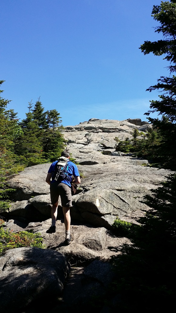
The hike up Cascade went fairly quickly and smoothly. We both felt like we were in pretty good shape after our Marcy summit a month prior, so we were excited to see how this went. Before we knew it we were on the last push above treeline.

Summiting Cascade
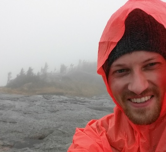
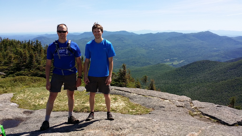
The ADK has a summit steward program which posts a person on many of the more popular High Peak summits during the summer months. They are there to educate hikers and keep them off the fragile plants that grow there. A very kind and knowledgeable young woman was posted on Cascade this day, and took our picture (the other, unofficial, duty of stewards). It’s one of my favorite pictures of us.

Brian and I on Cascade
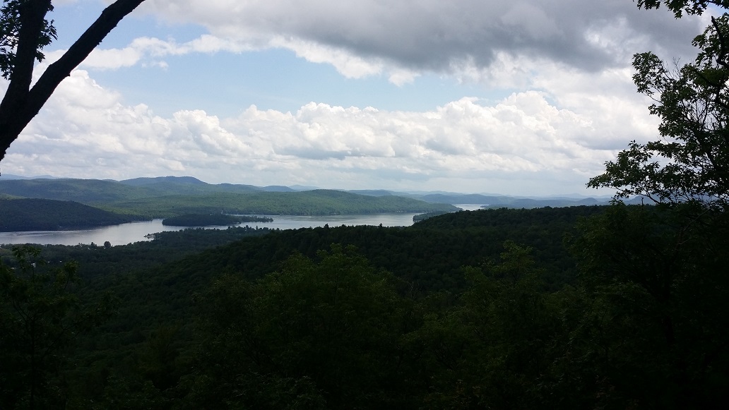
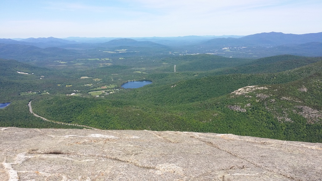
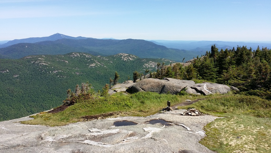
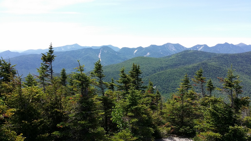
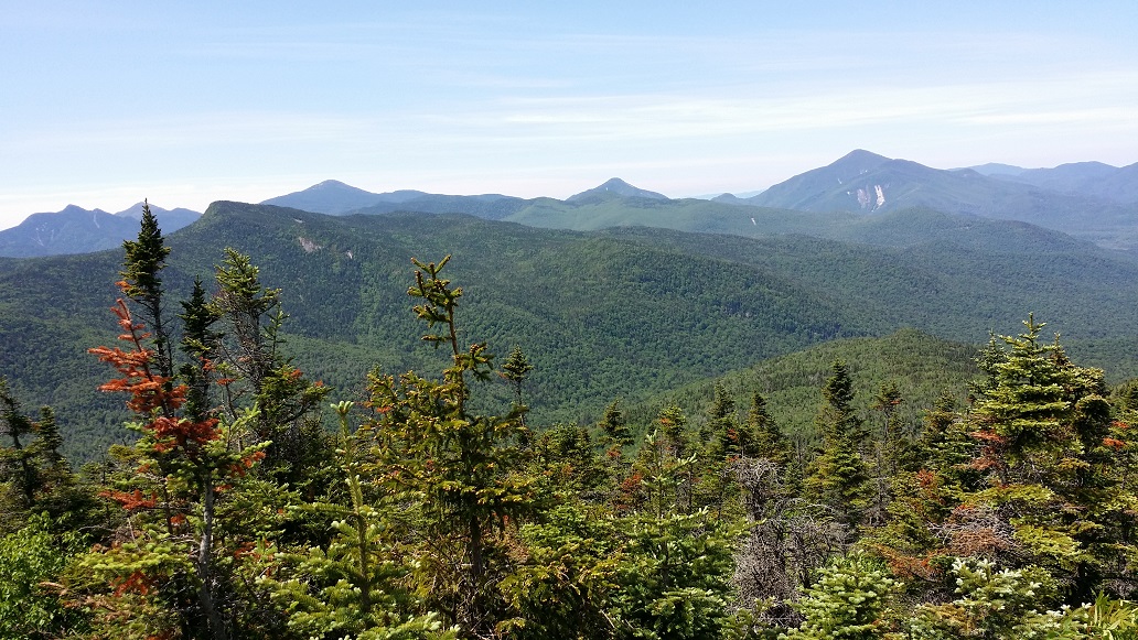
We were fortunate to summit during a lull, and spent quite a while chatting and enjoying the views.

Dix, The Great Range, Big Slide over Porter from Cascade
Dix, The Great Range, Big Slide over Porter
Marcy, Colden, Algonquin, etc etc
Facing East over Round Lake from Cascade
Facing East over Round Lake
Facing North over Pitchoff and Whiteface from Cascade
Facing North over Pitchoff and Whiteface

Feeling good, we hauled ass off Cascade back to the junction for Porter. There is a semi-technical descent for part of the 0.75 miles out to Porter. We passed a pair of women, one with a young child on her back, who was a 46er multiple times over. Climbing back up to Porter’s summit, the ascending fatigue returned and I slowed down. I still hadn’t achieved my climbing legs.

My Non-Beach Legs
My Non-Beach Legs
Porter
Porter

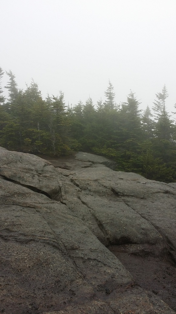
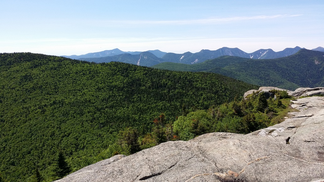
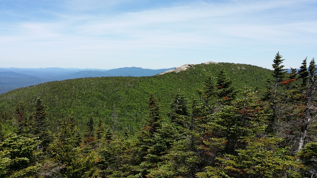
The summit of Porter is treed in, but it turns out there are still pretty good views over the tree tops.

Cascade from Porter
Cascade from Porter
The Great Range from Porter
The Great Range
Big Slide, Marcy, Colden, Algonquin from Porter
Big Slide, Marcy, Colden, Algonquin

Hike: Mt Severance
Distance: 2.4 miles
Elevation: 1693 ft
Total Ascent: ~800 ft
Date: June 21, 2015

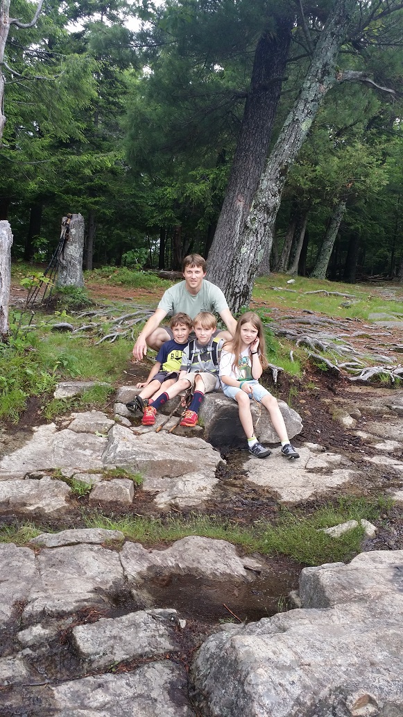
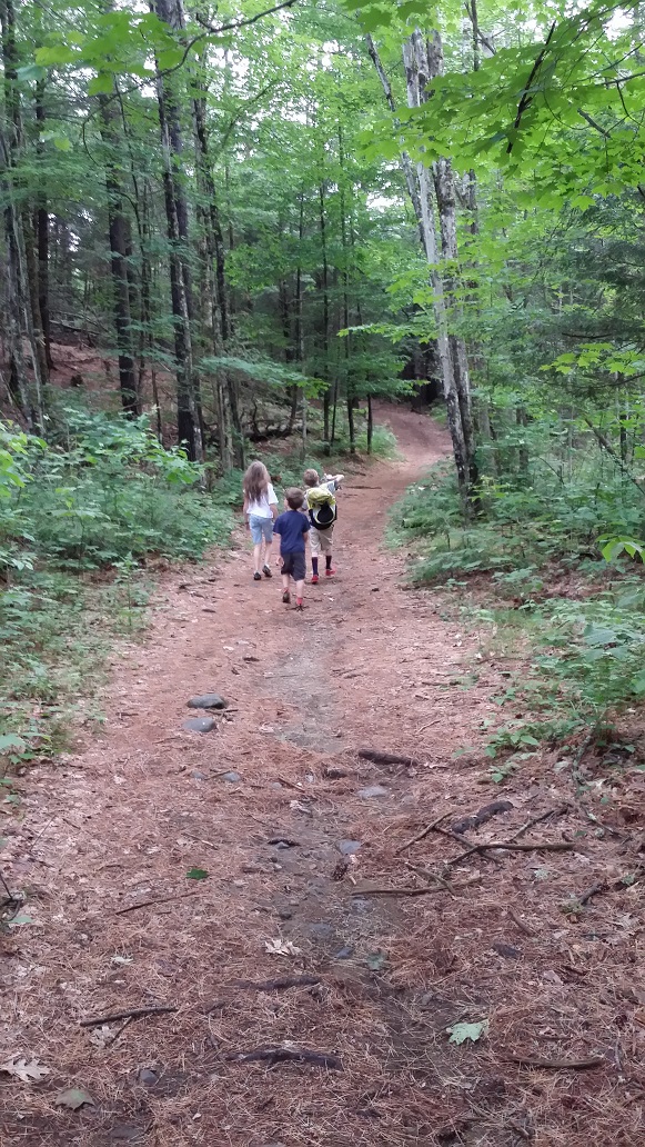
Sunday, Father’s Day, started with a nice motivating tantrum from my youngest. Clearly it was time to get into the woods. My children were not particularly interested, but I wanted them all to at least get a taste of the experience, and Mt Severance is a short climb with rewarding views, so it fit the bill.

The trail starts by literally tunneling under Interstate 87, followed by crossing some bridges over a bog area. Then the trail gets pretty easy, with very gradual climbing.

Kids Are Off!
Kids Are Off!
Jenks Men
Jenks Men

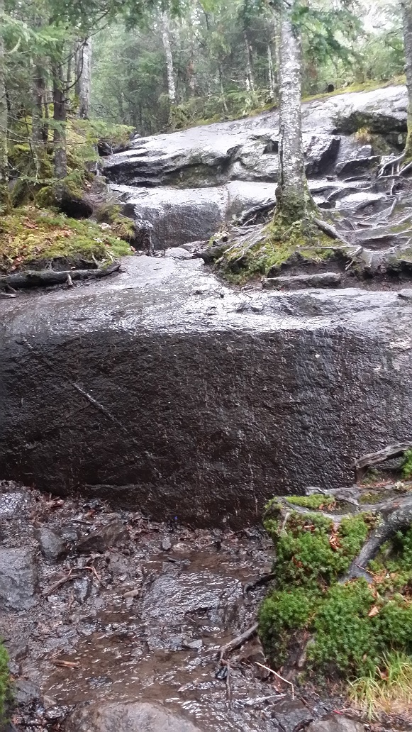
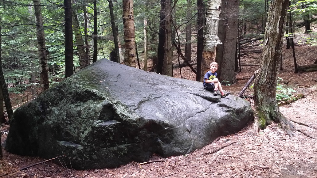
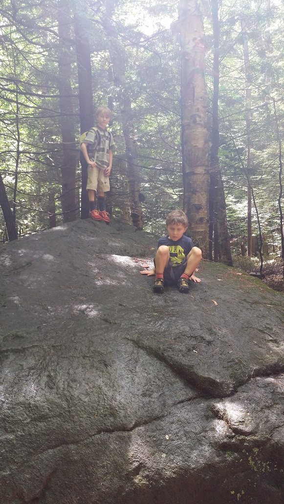
There are a few fun stops along the way, such as this giant rock.

Giant Rock

King of the Mountain

Having become used to longer, taller hikes, it was a surprise when we came to the summit. Not to the kids, however. My daughter, especially, was not particularly enjoying the experience. She now says she’s happy to have a helicopter drop her on top and she’d be willing to walk down.

Happy Father's Day
Happy Father’s Day
Schroon Lake from Mt Severance
Schroon Lake

Novice Meets a High Peak

Hike: Cascade and Porter Mountains
Distance: ~6.5 miles
Elevation: 4098 ft (Cascade) 4059 ft (Porter)
Total Ascent: ~2300 ft
Date: October 18, 2014

Has a place ever seemed more mythical than real in your mind? That was the High Peaks to me, as I didn’t have enough to fill in the blanks, having only visited superficially a few times as a kid. I had been obsessing about the area, what it looks like, what it feels like, since my little jaunt up Chimney Mountain three weeks earlier.

The High Peaks Wilderness is an area in the northern half of the Adirondack Park, and contains most of the biggest mountains of the park, and indeed the state. It’s a good 2 hour drive from my parents’ house, and 4 hours from where I live now.

High Peaks Wilderness
Image source

It was after 10 on a chilly October morning when my dad and I turned off I-87 onto route 73. “That’s Giant,” my dad said as a massive dome of earth came into view. “Yeah it is,” I replied, not realizing that Giant is one of the 46 Adirondack High Peaks, those originally measured to be over 4000 feet. Number 12 in the state, in fact, at 4627.

My head whipped back and forth, trying to take it all in. The mountains, the cliffs, the waterfalls, the lakes, the boulder strewn streams, all right off the road as it cut its way into the heart of the mountains. How was this right here this whole time and I hadn’t bothered to experience it? My dad filled the space with anecdotes about my grandfather’s experiences as a conservation officer, people who have climbed this or that, past climbs of his own back in the day. Hearing about all these places I hadn’t seen for myself only added to the mysticism. My brain struggled to keep up, wanting to absorb everything.

It was heavily overcast, and the forecast called for isolated showers that afternoon. I wasn’t too worried, but agreed that it would be a good idea to swing by The Mountaineer and grab a couple ponchos just in case. I had found an old backpack stuffed in the back of my closet that I had packed with some food and water, and a change of socks, but had little else to offer. Our plan was to hike Cascade and Porter. Cascade is often chosen as a first High Peak because of its relatively short distance from trailhead to summit, at just 2.4 miles, and as such it sounded like a good starter for me.

The trailhead parking area was full, despite being a cold and wet weekend well after the leaves had browned and fallen. We parked in another lot a few hundred yards down the road, threw our packs on, and took off. It was wet and muddy, and I was wearing Merrell Barefoot trail running shoes. I am a huge fan of minimalist footwear, but these have no traction in mud, and seem to suck any surrounding water straight into the bones of my feet. So I took the high ground, hopping from rock to rock, picking my way up the mountain as my dad slogged through the mud. The thing about Cascade, it turns out, is that sure, it’s a relatively short hike, but you’re still climbing 2000 feet over those 2 miles. My calves were not pleased the next day having done this by rock hopping.

Rock Hopping Over the MudWe leapfrogged with a few different groups of people on the way up, making the slog themselves. My dad would chat away with anyone and everyone. I would smile and say hello, ever the introvert. There was the couple from Pennsylvania who had made the long day trip, the girls from California, one of whom grew up in this area, etc etc.

The drizzle increased gradually as we climbed higher, and eventually I decided to put on my sexy bright orange poncho. People we passed who were coming down started looking harried as we got closer, making comments like “Whew, it’s rough up there!” It was only drizzling, so I brushed them off, thinking, “How bad could it possibly be? We’re only a quarter mile from the summit.” When we broke tree line, I found out what all the fuss was about.

The winds howled, the rain pelted sideways. The view ahead looked ghostly and threatening. We soldiered on. There were others nearby who climbed all the way to this point and chose to turn around.

Breaking Tree Line on Cascade“Welcome to the High Peaks! Respect …,” the mountain seemed to warn. As we made our way up the last scramble, the winds became even worse. It felt like a hurricane. The rain stung my face and I looked away to ease the blows. At the summit, my dad fumbled with my phone trying to get my picture, but quickly gave up and retreated, having elected not to put on his poncho. I took a selfie and then hunkered down behind a rock. I was not going to be denied the experience of breathing this in for a few minutes, even if I was sitting in the middle of a big bowl of milk. I was on top of the world. I didn’t realize at this time how rare it is to be alone on top of Cascade.

Cascade SummitHeading back down, the weather almost immediately improved, as if the mountain had delivered its message and moved on. At the tree line I decided to get the poncho off, and struggled like a toddler getting tight pajamas off over his Tweety Bird head, eventually ripping the damn thing in half.

Back down at the junction to Porter, Cascade’s neighboring mountain, we decided since the weather was improving and it was only 3/4 of a mile to its summit, we should grab it while we were there. We stopped for a quick bite to eat, and I received my next lesson. Bananas don’t make the best trail food. It was mushed all over everything in my pack.

The trail over to Porter drops a few hundred feet into the col, and then climbs back up to its summit. The going was a bit more rugged, although not steep, and very wet.

Trail to PorterIt was difficult to even be sure we had reached the summit as there is no marker and the trail continues onward, but another guy we ran into assured us that this was it. The weather had cleared a bit, and it is treed in, so although the experience was quite a lot more pleasant, it was still lacking for views.

Porter SummitPorter Summit ViewThe hike down felt lighter. I had survived my first high peak, two in fact, and the skies were clearing. A new goal began to take shape. I like checklists. I like the Adirondacks. I like hiking. Maybe this is the start of a journey to become a 46er. 46 4000+ foot mountains in the Adirondacks. 2 down, 44 more mountains waiting for me to experience, to learn from. I was already drooling for the next hike.